|
|
MIDDLESEX
The administrative and historic boundaries around Middlesex diverged very early on, with the recognition of the City of London as an independent county borough. In 1888 much of the area became part of the County of London - the present-day boroughs of Camden, Hackney, Hammersmith and Fulham, Kensington and Chelsea, Islington, Tower Hamlets and Westminster were removed. During the next few decades the county became almost entirely urbanised by suburbs of London. Towards the end of the period, many of the boroughs in the area were demanding independence from Middlesex County Council as county boroughs, which if granted would have left Middlesex County Council controlling an area with three distinct and unconnected fragments - in the west, the south-east and the north of the county. Instead, in 1965, nearly all the remainder of Middlesex was subsumed by the new Greater London except the Potters Bar district; which was ceded to Hertfordshire, and the district of Spelthorne, which were ceded to Surrey. The greater part went to form the new London boroughs of Brent, Ealing, Enfield, Haringey, Harrow, Hillingdon, and Hounslow. Middlesex is still used as a placename, and exists in the name of such organisations as the Middlesex County Cricket Club or Middlesex University. Royal Mail guidelines now leave the use on letters of the historic county, administrative county, or no county at all up to the personal preference of the addresser, and Middlesex is consequently commonly found on addresses outside the London postal districts (and sometimes, even within). From an organisational point of view the Royal Mail does however recognise the existance of an area called Middlesex as one of the Postal counties of England but confusingly it is not identical to the historic county boundaries - not only have large sections formed part of the London postal district but elsewhere the borders occasionally follow a different course, such as the village of Denham which is in both the traditional and administrative county of Buckinghamshire but in the postal county of Middlesex. In the area around Richmond upon Thames
and Twickenham, one bank of the River Thames is
often referred to as the "Middlesex Bank" , with
"Surrey Bank" for the opposite side of the river
- this identification is especially useful where
the river flows in a north-westerly direction
thus making the terms "north bank" and "south
bank" somewhat confusing.
|
|
||||||||||
| THE MIDDLESEX FEDERATION (MF) CLICK FOR THE MIDDLESEX FEDERATION
|
|||||||||||
| A
Widget by Frixo Traffic Reports | View All Motorways |
The Weather in
London B To plan your journey by car or public transport click on to the Door-to-Door Journey Planner  |
||||||||||
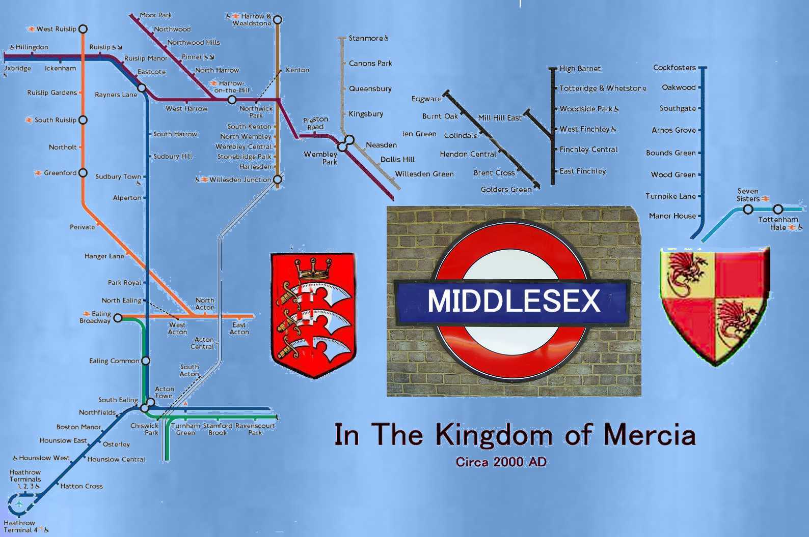 CREATED IN MEMORY OF HARRY BECK UK: Middlesex on line Donald Strachan discovers how a rural county was swallowed up by London's suburbs. Daily Telegraph 30 Nov 2004 |
|||||||||||
| Suburbia doesn't seem the
obvious place for an architectural and historical
walking tour. Yet north-west London, where the
capital stretches its legs into unassuming suburbs
such as Pinner and Neasden, is the unlikely venue
for the Transport Museum's guided visits to
Metro-land. This densely populated area grew up around the Metropolitan Railway in the 1920s and '30s. The Met, as it was known to workers and passengers, wasn't built to serve communities, but to create them. When urban London spread into rural Middlesex the countryside vanished - almost overnight tithe barns and ancient copses made way for signal boxes and model high streets. The rail commuter was born. I meet my guide, David Wadley, at Baker Street. He is a charming chartered mechanical engineer and Transport Museum guide, still enjoying his 65-year love affair with London's railways. After a talk and tour of the station - the former Met headquarters - we take the train and head west to Rayners Lane. "Originally, this station was nicknamed Pneumonia Junction," says Wadley, apparently after the winter wind that whistles down from the Chilterns. The station's design is typical of Piccadilly Line architect Charles Holden, a leading figure of London Underground design. Towering glass windows, now showing their age, bathe the ticket hall in light. At night, from its hill, the station beams like a lighthouse over a sea of Metro-land houses stretching northwards to Headstone and beyond. Wadley points out a fine piece of radical suburban architecture across the road. The former Grosvenor Cinema, now a Zoroastrian Centre, has seen better days, but remains as evocative of a time and place as Tower Bridge or Tate Modern. Plain plaster surfaces and sweeping curves echo classic European modernity. But the heart of Metro-land lies a short walk down the hill, at the end of a curious high street that looks like (and probably was) one developer's idea of "typical" suburbia. It is Metro-land's flagship development: E S Reid's Harrow Garden Village estate. When it was begun in 1929 next to Rayners Lane, annual traffic through the new station was 30,000 passengers. Within eight years it was four million. Most of the estate's houses are classic Metro-land: angular, semi-detached, with inelegant bay windows and steep tiled roofs. Each differs minutely and obsessively from its neighbour, with no concession to architectural modernism. But on a good day the area still glows with the Metro-land dream. Birds twitter and chirp in the hedges. Trees line every street. The Yeading Brook, marking the boundary of the estate, babbles along the roadside. We linger at The Close, reminiscent of an idealised village green with its picture-perfect village hall, missing only a weeping willow and duck pond. Wadley points out the architectural delights of Tudorbethan semis and smarts at the incursion of a more recent suburban scourge: inappropriate (plastic!) double-glazing. Standing here, I sense not only the history - the who, how, what and where of Metro-land - but also the why. Compared with the drudgery of the inter-war inner city, this was a place, said one early suburban settler, that "adds a thrill and a zest to life". |
And those slightly awkward
suburban semis? They look magnificent - sleepy,
quintessential England. There's even something
egalitarian at work; a sort of utopian communism
with hanging baskets. From here, in the decade leading up to the war, Metro-land spread unchallenged. Eastcote and Ruislip, once a holiday resort for consumptive Londoners, were absorbed. Hillingdon, Ickenham and the nearby Swakeleys estate, later immortalised in the name of a roundabout on the A40, joined the sprawl. Where no village name existed, the Met ran public competitions to create one: Northwood Hills and Queensbury were born by artificial urbanisation. How the old Harrovians, sitting on their hill, must have watched in horror as Metro-land swallowed old Middlesex whole. The rural peace of their Italianate villas and Doric porches breached forever by the electric hum of the Metropolitan Railway. Cheap mortgages had made the impossible affordable. And the people kept coming, cannibalising the rural idyll they were chasing and replacing it with a voracious suburbia. "The countryside was galloping backwards as fast as people could find it," Wadley observes. On Park Drive, a typical off-the-peg street name, he shows me a secluded, now decrepit public tennis court. This was the brave new world that the 1930s family was chasing, and there was to be no halting progress. To the upwardly-mobile, says Wadley, the "suburban residence was many individual Englishman's idea of his home, except for the cosmopolitan rich, a minority of freaks and intellectuals and the very poor". And this was the real Metro-land innovation. "You have to see it as one big advertising sales pitch, a package deal," says Wadley. "Ride our trains, live in our houses, enjoy our countryside." But in the process the old country has gone.
Riding the Met now, through Northwick Park and
Neasden, it isn't hard to imagine these bus lanes
and flyovers as meadows and beech trees - it's
impossible. Further information
Times, dates and group sizes are flexible and by arrangement with the museum. Call or e-mail the Group Coordinator (020 7565 7265; email: group visits@ltmuseum.co.uk). People can also join a pre-arranged tour by contacting the Resource Desk (020 7379 6344). For an unusual and eclectic take on Metro-land, including some excellent John Betjeman links, visit www.metroland.org. The 1924 edition of Metro-land, a dedicated guide published annually between 1915 and 1932, has been published by Southbank (£16.99) with a new introduction by Oliver Green, head curator of the Transport Museum. |
||||||||||

|
 Details |
|
Heathrow
Tourist information Centre
|
Heathrow Terminals 1, 2, 3 Underground Station Concourse , Heathrow Airport , Middlesex , TW6 2JA Tel: 09068 663344 (Calls charged) |
|
Harrow
Tourist Information Centre
|
Address:
Civic
Centre,
Station Road, Harrow, Middlesex, HA1 2XF Email: info@harrow.gov.uk Tel: 020 8424 1102 |
| Heathrow Tourist information Centre |
Heathrow
Terminals 1, 2, 3 |
|
Hounslow
Tourist
information
Centre
|
Address: The Treaty
Centre, High Street, Hounslow, Middlesex, TW3 1ES Email:tic@cip.org.uk Tel: 0845 456 2929 |
|
Piccadilly
Tourist information
|
Piccadilly
Circus
1 Regent Street , Piccadilly Circus , SW1Y 4XT |
Twickenham Tourist Information Centre |
Address: The Atrium, Civic Centre, 44 York
Street, Twickenham, Middlesex, TW1 3BZ |
|
UxbridgeTourist
information Centre
|
Tourist Information (Office & Administration) based in the High Street area of Uxbridge Tel: 01895 250706 Address: Central Library, High Street, Uxbridge, Middlesex, UB8 1HD |
| Victoria Tourist information Centre | Victoria Station Forecourt , SW1V 1JU Tel: 09068 663344 (Calls charged) |
| Waterloo Tourist information Centre | London Visitor Centre ,
Arrivals Hall , Waterloo Int Terminal , SE1 7LT Tel: 09068 663344 (Calls charged) |
 |
The County of
Middlesex together with Central London,
Hertfordshire and Essex makes up most of what is
known as "THE BEIGAL BELT". Full details about
the Beigal Belt may be read by clicking onto the Kosher page.
There you will find out the Kosher
Restaurants, learn about Jewish Immigration to the
UK, find Jewish places of interest to visit and
pick up a few culinary tips. Obviously this has
been created for those of the Jewish Faith.
Middlesex being so diverse we hope that other
minorities will provide us with their details for
inclusion. |
| Middlesex Hosts The Main English Places
for: Cricket (Lords Cricket Ground),
Soccer(Wembley Stadium) and Rugby Football
(Twickenham), Heathrow is London & England's
foremost airport.The UK MoD has a Permanent Joint
Headquarters (PJHQ) at Northwood in Middlesex for
joint military operations.NATO headquarters are
also there. |
|
| Acton | Barnet | Brentford | Chiswick | Ealing |
| Edgware | Edmonton | Enfield | Feltham | Finchley |
| Friern Barnet | Harrow | Hayes and Harlington | Hendon | Heston |
| Hornsey | Ickenham |
Isleworth &
Heston |
Mill Hill | Potters Bar |
| Ruislip & Northwood | Southall | Southgate | Staines | Stanmore |
| Sunbury-on-Thames | Tottenham | Twickenham | Uxbridge |
Wembley |
| Willesden | Wood Green |
Yiewsley and West Drayton | The Gardens of Middlesex |
|
| Greenford | The Great British Diary of Events | Hounslow |
Middlesex
CCC |
Hornsey |
ATTRACTION |
PICTURE |
ADDRESS & CLICK |
Tel NO | |||||||||||||||||||||||||||||||||||||||||||||
| We are
endeavouring to include Multi Ethnic Food outlets in
Middlesex and would be obliged to any member of those
communities who can supply us with details. We have
included Kosher food and trust we can soon include Halal
and other such food outlets. Great
British Heritage Pass - Visit Britain with the
Great British Heritage Pass - the best of British
sightseeing and historic Britain for UK visitors.
Get free entry to almost 600 British heritage
tourist attractions around England, Scotland, Wales
and Northern Ireland.
|
||||||||||||||||||||||||||||||||||||||||||||||||
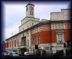
| Acton Towards the end
of the 17th century several springs were found on
the north-east side of Acton and, for a time, they
became health spas. As a result of the local soft
water Acton became famous for its laundries and at
the end of the 19th century there were around 170
establishments in South Acton. These laundries would
serve hotels and the rich in London's West End,
leading to the nickname "soapsuds island".Acton is
home to the largest housing estate in West London,
the South Acton estate, with approximately 2,000
homes and 5,800 residents.[3] This area is currently
in the Phase 2 of a major 15-year phased
regeneration which includes near-total demolition of
the existing residential units, and the construction
of new and more numerous residential units. Since
World War II, Acton has had a small but notable
population of Polish immigrants. In recent years, a
number of Antipodean immigrants have settled there;
there are several Australian and South African pubs
concentrated in a small area. Other substantial
immigrant groups include Iraqis and Somalis. A
Japanese school has attracted a Japanese community
to West Acton.
|
 |
actonW3.com:
Acton community website sarag.org: Residents' association for South Acton Moosehead Acton Triva Quiz site Stardom in Acton video on YouTube Transport for London: Official site for West London Tram scheme History of Acton website British History Online - Acton Acton Farmers' Market Website Council Tax charges in 2007/08 |
||||||||||||||||||||||||||||||||||||||||||||||
|
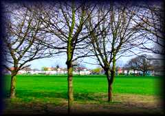
NORTH ACTON PARK
North Acton Park is positioned in the north of
the suburb up the hill away from the busy streets of
Acton High Street. Surrounded by largely residential
buildings the park is a popular place for people to
exercise and play sports. The park has a small
pavilion and a tennis court and basketball court as
well as a fine children’s playground in one corner.
From the park one can see the magnificent arch of the
new Wembley Stadium. |
 |
Eastfield
Road,
North
Acton, London W5 3EE Map |
||||||||||||||||||||||||||||||||||||||||||||||
|
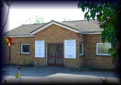
OLD OAK
METHODIST CHURCH
This modern Methodist Church is situated close to
the public park of The Green at the centre of the east
Acton residential community. The church is simple in
its design but still attracts a large and loyal
congregation from across the area. The church likes to
be part of community and charitable local affairs and
takes an active role in both. |
 |
The
Fairway, East Acton, London W3 Map |
||||||||||||||||||||||||||||||||||||||||||||||
|
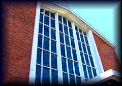
ST AIDAN'S
CHURCH
St. Aidan's is a fine looking Catholic Church
located on one of the main shopping streets of east
Acton close to the Underground Station. The church has
been one of the primary places of worship for
Catholic's in the area for many generations and draws
an interesting and eclectic congregation from across
the social spectrum. |
 |
Old
Oak Common Road, East Acton, London W3 Map |
||||||||||||||||||||||||||||||||||||||||||||||
|
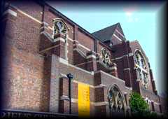
ST. GABRIEL'S
CHURCH
This building was constructed in the late 1920s
and is an interesting example of the neo-gothic
revival that was taking place in ecclesiastical
architecture at this time. The church is well
crafted and a great deal of attention has been spent
on the detail especially around the windows and
doors. The building houses a friendly and lively
Christian community in the North of Acton. |
 |
Noel
Road, Acton, London W3 7GT Map |
||||||||||||||||||||||||||||||||||||||||||||||
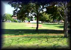
THE GREEN
The Green is a public park situated just off Old
Oak Common Road close to the main shopping streets of
the area. The park is well appointed with mature trees
around the edge and well kept lawns within. It has
been a place of rest, recreation and relaxation for
the people of the suburb for many years and continues
to attract visitors today. |
 |
|||||||||||||||||||||||||||||||||||||||||||||||
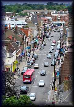
| Barnet Was originally in Hertfordshire but is included as parts of the London Borough of Barnet were in Middlesex. The town was the
site of the Battle of Barnet in 1471 (more
accurately, Hadley), where Yorkist troops
led by King Edward IV killed the rebellious
"Kingmaker" Richard Neville, Earl of Warwick
and Warwick's brother, John Neville, 1st
Marquess of Montagu. It is the site of an
ancient and well-known horse fair, hence the
Cockney rhyming slang of Barnet Fair or barnet
for "hair". The fair dates back to 1588 when
Queen Elizabeth I granted a charter to the Lord
of the Manor of Barnet the right to hold a twice
yearly fair.
Chipping Barnet (chipping meaning market) was historically a civil parish of Hertfordshire and formed part of the Barnet Urban District from 1894. The parish was abolished in 1965 and the Chipping Barnet section of its former area was transferred to Greater London and the newly-created London Borough of Barnet. In 1801 the parish had a population of 1,258 and covered an area of 1,440 acres By 1901 the parish was reduced to 380 acres (1.5 km²) and had a population of 2,893. In 1951 the population was 7,062. In Saxon times the site was part of an extensive wood called Southaw, belonging to the Abbey of St Albans. The name of the town appears in early deeds as 'Bergnet' - the Saxon word 'Bergnet' meant a little hill (monticulus). Barnet's elevated position is also indicated in one of its alternative names ('High Barnet'), which appears in many old books and maps, and which the railway company restored. According to local belief, though not verified, "Barnet stands on the highest ground betwixt London and York." The area was historically a common resting point on the traditional Great North Road between the City of London and York and Edinburgh. At the turn of the 21st century, a tongue-in-cheek movement calling for the name Barnet to be changed to "Barnét" began to gain the attention of the public and the national media, with many public road signs in the area regularly being altered to contain the accented character. . Despite some support from residents, Barnet Council has been treating any such alterations to public road signs as vandalism. |
 |
The Barnet Society Barnet Symphony Orchestra Barnet YHA local group |
||||||||||||||||||||||||||||||||||||||||||||||
East Barnet & EN4
Kosher Food Click
here for Kosher Eateries
|
||||||||||||||||||||||||||||||||||||||||||||||||
|
BARNET LOCAL
STUDIES & ARCHIVES
The public archives are filled with records of
this borough of London, and the many that have
preceded it. As a visitor you can enjoy leafing
through the many texts that are on display and learn
more about the foundations of this area, how the
people used to live, and how the development of Barnet
has changed their lives. The helpful and well trained
staff will assist you in finding what you're looking
for and be able to answer any questions that you might
have. |
80
Daws Lane, Barnet, London NW7 4SL Map E-mail Barnet Local Studies & Archive |
Phone: +44 (0)20 8959 6657 | ||||||||||||||||||||||||||||||||||||||||||||||
|
BARNET MUSEUM
This area of London has a long and interesting
history, much of which has been recorded and kept on
display in this museum. If you are keen to learn more
about the way that Barnett has developed through the
ages, this collection will certainly be the year. The
displays include artefacts, documents, maps and
pictures which helped to bring to life history of the
area. A well organised collection, the whole family
can enjoy an interesting and informative experience. |
31
Wood Street, Barnet, London EN5 4BE Map |
|||||||||||||||||||||||||||||||||||||||||||||||
| BERNIE GRANT
ARCHIVES Bernie Grant
was a member of parliament in North London and
became well known as being one of the most outspoken
and influential politicians on matters of race
relations in British society. This fascinating
collection is housed within the University of
Middlesex and brings together many of his personal
papers and artefacts from an illustrious career. It
is designed so that visitors can learn more about
the man and the causes that he supported.
|
Middlesex
University,
Cat
Hill, Barnet, London EN4 8HT Map BERNIE GRANT ARCHIVES CLICK |
Phone: +44 (0)208 411 6686 | ||||||||||||||||||||||||||||||||||||||||||||||
|
LESBIAN &
GAY NEWSMEDIA ARCHIVES
This extensive archive houses over 200,000 pieces
of press coverage that relate to lesbian, gay and
bi-sexual news that has been reported since 1930. The
archive has become one of the most important
historical resources for those following the social
development of gay people in society, and offers a
fascinating insight into the way that attitudes have
changed as times have gone on. |
Cat
Hill Campus, Barnet, London EN4 8HT Map Gay Newsmedia Archive Web site |
Phone: +44 (0)208 411 4933 | ||||||||||||||||||||||||||||||||||||||||||||||
| Museum of Domestic
Design & Architecture MoDA is part of
Middlesex University, but is also a public museum
with free entry for everyone. Their varied
exhibitions give a vivid picture of domestic life in
the first half of the 20th century, while also
looking at contemporary design, art and issues
related to the domestic environment. MoDA's
outstanding collections throw light on what homes
were like and how people lived in them.
Workshops and events provide educational,
informative and entertaining experiences for adults
and children alike. MoDA has truly become the
museum where everyone can feel completely at home.
|
Middlesex
University,
Cat
Hill, Barnet, Herts, EN4 8HT MODA CLICK |
Tel: +44 (0)20 8411 5244, fax: +44 (0)20 411 6639 | ||||||||||||||||||||||||||||||||||||||||||||||
|
THE RUNNYMEDE
COLLECTION
The Runnymede Collection is based at the
University of Middlesex and makes up a unique resource
related to the study of race relations in Britain
since the 1960s. It carries an extensive collection of
pamphlets, books, magazines, journals and periodicals
on the subject. The collection is managed by the
Racial Equalities Studies Department at the university
and is open to the public throughout the year. |
Cat
Hill, Barnet, Hertfordshire EN4 8HT Map The Runnymede Collection Web site |
Phone: +44 (0)208 411 6686 | ||||||||||||||||||||||||||||||||||||||||||||||
| Brentford The settlement
pre-dates the Roman occupation of Britain, and
thus pre-dates the founding of London itself.
Many pre-Roman artifacts have been excavated in
and around the area in Brentford known as 'Old
England'. Bronze Age pottery and burnt flints
have been found in separate sites in Brentford.
The quality and quantity of the artefacts
suggests that Brentford was a meeting point for
pre-Romanic tribes where part of tribal rituals
included the ceremonial casting of weapons into
the river. One well known Iron Age piece from
about 100 BC - AD 50 is the Brentford
horn-cap - a ceremonial chariot fitting
that formed part of local antiquarian Thomas
Layton's collection , now held by the
Museum of London. The Celtic knot pattern (the
'Brentford Knot') on this item has been copied
for use on modern jewellery.It has been
suggested that Brentford was also a main fording
point on the River Thames, and was the point
where Julius Cæsar crossed the Thames during his
invasion of Britain. It is asserted, without
strong evidence, on the Brentford Monument, that
a documented battle fought at this time between
Cæsar's forces and Cassivellaunus took place at
Brentford[1]. There are, however, two other
historically accredited battles of Brentford in
1016 and 1642.New Brentford was first described
as the county town of Middlesex in 1789, on the
basis that it was the location of elections of
knights for the shire (or Members of Parliament)
from 1701. In 1795 New Brentford (as it
was then) was "considered as the county-town;
but there is no town-hall or other public
building" causing confusion that remains to this
day.
Companies in Brentford
|
Brentford Dock residents' website Brentford, Chiswick & Isleworth Times online Gunnersbury Park Museum Museum of London page on the Brentford horn-cap showing the 'Brentford Knot' pattern Thomas Layton & his Collection GlaxoSmithKline's Global Headquarters at Brentford The Gillette Building, Brentford Fairly comprehensive amateur local history website on Brentford Brentford High Street project: people and properties 1840 - 1940 Soul in Brentford The Brentford Biopsy The Brentford Pages - modelling the GWR Brentford Branch |
|||||||||||||||||||||||||||||||||||||||||||||||
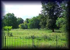
| Boston Manor Park is a
large public green area in the west London suburb of
Brentford. The park has for generations been
designated by the local authorities as a place of
rest and recreation for local people. Once
associated with the ancient Boston Manor, today the
park is mainly used by locals and tourists for
picnicking, running, walking and games.
|
 |
Brentford,
London TW8 Map BOSTON MANOR PARK CLICK |
||||||||||||||||||||||||||||||||||||||||||||||
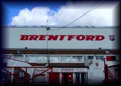
| Brentford Football
Club was founded in
1889 and since that time has been a significant part
of the social life of the west London suburb.
Although never really having tremendous success at
the very highest level of football, the club has
consistently performed in the English professional
game and has had several notable cup runs. Games are
played at the home ground around once every ten days
in the football season. Chelsea FC reserves also
play here.
|
 |
Phone: +44 (0)8453 456 442 | ||||||||||||||||||||||||||||||||||||||||||||||
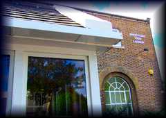
| Brentford Free
Church is a
small community facility based at the heart of the
west London suburb. The church has its roots in
ancient non-conformism, but this particular building
is relatively modern. It is home to a a large and
friendly Christian community who take an active role
in community and charitable affairs.
|
 |
Phone: +44 (0)20 8560 7495 | ||||||||||||||||||||||||||||||||||||||||||||||
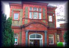
| Brentford Library Andrew
Carnegie, the Scottish American philanthropist and
businessman funded this tremendous Victorian
building in the heart of Brentford. The library has
for well over a century served as one of the central
focuses of community life in the suburb. It has a
large collection of books and other media for loan
as well as an extensive research section and some
interesting pieces of local history.
|
 |
Phone: +44 (0)20 8560 8801 | ||||||||||||||||||||||||||||||||||||||||||||||
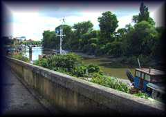
| The Brentford
River Path is part of the
larger Thames Pathway system of walks that run along
the banks of the Thames in central London and out
along the suburban sections. Brentford River Path
offers exceptional views and beautiful surroundings
as visitors track the banks of the ancient river
towards Kew Gardens and central London or out of
town in the direction of Twickenham.
|
 |
Riverside,
Brentford,
London
TW8 Map |
||||||||||||||||||||||||||||||||||||||||||||||
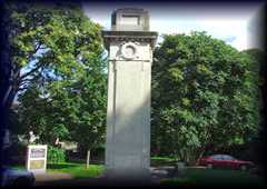
| Brentford War
Memorial stands solemnly
outside the main library in the town in a small area
of parkland that is sheltered by shady trees. The
memorial commemorates those lost during both the
First and Second World Wars from the area of
Brentford. It also serves as a celebration of the
courage of all those who fought for the basic rights
that we take for granted in this country today.
|
 |
Boston
Manor Road, Brentford, London TW8 8DW Map |
||||||||||||||||||||||||||||||||||||||||||||||
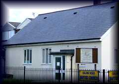
| Ealing Road
Baptist Church is a small and
understated place of worship housed in a modern low
lying building on the edge of Brentford close to
Ealing in west London. The church takes an active
role in the life of the local community and enjoys a
large and committed congregation of local people who
enjoy worshipping and praying on the site.
|
 |
Ealing
Road, Brentford, London TW8 Map |
||||||||||||||||||||||||||||||||||||||||||||||
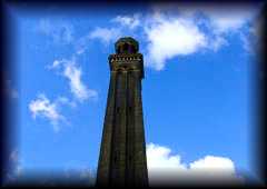
| Kew Bridge Steam
Museum can be spotted
from many miles away thanks to the huge brick
chimney that towers above the museum at its centre.
The museum pays homage to the age of steam and
contains a great many working examples of steam
machines and vehicles that developed quickly during
Victorian times and helped to carry us into the
modern age.
|
 |
Green Dragon lane,
Brentford, London TW8 OEN
|
Phone: +44 (0)20 8568 4757 | |||||||||||||||||||||||||||||||||||||||||||||
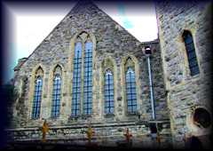
| Brentford Musical
Museum is housed
in a redundant church about seven miles to the west
of the centre of London. The museum as its name
suggests is a large collection of musical
instruments and related artefacts from the very
beginnings of automated noise to the present day. It
is thought to be one of the finest collections of
its type in he world.
|
 |
368 High Street,
Brentford, London TW8 OBD
|
Phone: +44 (0)20 8560 8108 | |||||||||||||||||||||||||||||||||||||||||||||
|
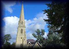
St. Paul's Church
is one of the
largest and most impressive architecturally in the
suburb of Brentford in west London. The church is
situated close to the main shopping streets and
towers above the surrounding residences. The
church is home to a large and ethnically diverse
Christian congregation who meet on a regular basis
for prayer and to organise community events.
|
 |
St.
Paul's Road, Brentford, London TW8 Map |
||||||||||||||||||||||||||||||||||||||||||||||
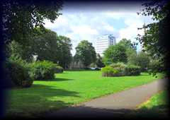
| St. Paul's Park is a large
outdoor green area relatively close to the central
shopping streets of Brentford in west London. The
facility is well used by local people who for
generations have enjoyed this area of greenery as a
place of rest and relaxation, away from the busy
roads of the central areas of town. The park has a
children's playground within it.
|
 |
Boston
Manor
Road,
Brentford, London TW8 Map |
||||||||||||||||||||||||||||||||||||||||||||||
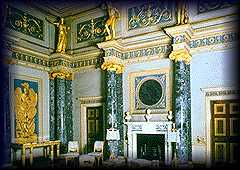
| Syon House &
Gardens has been
home to the Duke of Northumberland and his family
for over four hundred years. Just 10 miles from
central London, the house is surrounded by its own
parkland landscaped by Capability Brown, and Kew
Gardens is just across the Thames. Originally the
site of a late medieval abbey, Syon House has Tudor
origins and contains some of Robert Adam’s finest
interior work, which was commissioned by the first
Duke of Northumberland in the 1760s. The venue is
availble for private hire and weddings, as a film
location, or simply for a family day out.
|
 |
|
Phone: +44 (0)20 8560 08823 - Fax: +44 (0)20 8568 0936 | |||||||||||||||||||||||||||||||||||||||||||||
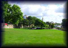
| Syon Park is one of the
largest green areas in central Brentford and is
situated in a beautiful location next to the River
Thames. The park is a popular with locals and
visitors alike and contains a wealth of facilities
including a children's playground. The park is
primarily used as a place of rest, relaxation and
recreation by people wishing to experience some
tranquillity without having to leave London.
|
 |
Brentford
High
Street,
Brentford, London TW8 Map SYON PARK CLICK |
||||||||||||||||||||||||||||||||||||||||||||||
|
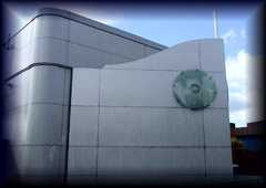
Watermans Art Centre
is located at
the heart of Brentford in west London, close to
the river Thames. The centre is a multi purpose
facility containing a range of open access
facilities for the public. The centre has a cinema
showing the best in world cinema, and art gallery
which hosts shows from local artists and visiting
exhibitions from across the globe as well as
holding regular workshops and seminars.
|
 |
40 Brentford High
Street, Brentford, London TW8 ODS
|
Phone: +44 (0)20 8232 1010 | |||||||||||||||||||||||||||||||||||||||||||||
| CHISWICK Chiswick grew
up as a fishing village around St. Nicholas church
on Church Street, but the name Chiswick later became
used for a wider area, formed originally by merging
the four villages of Chiswick, Strand-on-the-Green,
Little Sutton and Turnham Green. By 1815, Chiswick
parish included all the area bounded by the loop of
the Thames, the High Road west of Turnham Green, the
north side of Chiswick Common and Bath Road to
Goldhawk Road. In 1896, "Bedford Park, Chiswick" was
advertised, which at that time was partly in Acton
Urban District. For centuries fishermen and watermen
have used the waterfront of old Chiswick to deliver
goods to riverside businesses and the surrounding
area. By the early nineteenth century the fishing
industry in and around Chiswick was declining as the
growth of industry and the invention of the flush
toilet were causing pollution in the river. Fish
began to die out and the river became unsuitable as
a spawning ground. Locks upstream also made the
river impassable by migratory fish such as salmon
and shad. From the 18th century onwards the High
Road became built up with inns and large houses.
Today the High Road is a busy shopping street with
many cafes, restaurants and several 19th century
public houses. Chiswick is the birthplace of the
modern domestic violence refuge movement, with the
first shelter established by Erin Pizzey in 1971.Blue plaques have been
erected for the following people:
Jack Beresford, Olympic
rowing champion, E. M. Forster, novelist,
Joseph
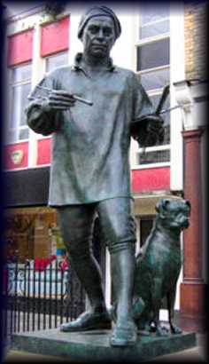
Michael Gandy, architect and painter, Private Frederick Hitch, (V.C.) hero of
Rorke's Drift, John Lindley, botanist
and pioneer rchidologist, Lucien Pissarro,
painter, print-maker and wood engraver, Alexander Pope, poet
and Johann Zoffany, painter
|
 |
Chiswick's local community web site Virtual Tour of Chiswick A few Old Postcards of Chiswick Chiswick history website Chiswick: Growth, A History of the County of Middlesex: Volume 7: Acton, Chiswick, Ealing and Brentford, West Twyford, Willesden, (1982) |
||||||||||||||||||||||||||||||||||||||||||||||
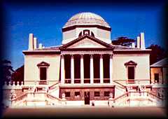
| Chiswick House Set amid the
hustle and bustle of west London lies Chiswick House
and Gardens, a beautiful and inspiring oasis of
tranquility that is uniquely important.The
magnificent neo-Palladian villa is considered a
design masterpiece, and the gardens are widely
credited as the birthplace of the English landscape
movement, creating a revolution in garden design
that swept the world. Over the centuries celebrated
figures have come to Chiswick House and Gardens
seeking pleasure and inspiration. The villa was
completed by Lord Burlington in 1729 and it was at
Chiswick that he entertained notable visitors, such
as Handel, Alexander Pope and Jonathan Swift. This
tradition was upheld by the beautiful and
controversial Georgiana, Duchess of Devonshire who
called Chiswick House 'my earthly paradise'. In more
recent times, the Beatles used the gardens as the
backdrop for 'Paperback Writer' and 'Rain'. Today,
the property and grounds are enjoyed by 1 million
people each year. Over the next two years, the
Chiswick House and Gardens Trust is undertaking one
of the country's biggest and most ambitious garden
restoration projects, investing £12.1 million to
restore the gardens to their full 18th century
glory.
|
 |
Burlington Lane,
London W4 2RP
|
Phone: +44 (0)20 8995 0508 - Fax: +44 (0)20 8742 3104 | |||||||||||||||||||||||||||||||||||||||||||||
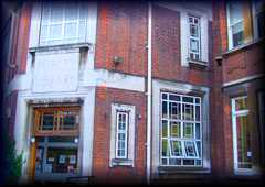
| Chiswick Library is a good
looking old building situated a few streets away
from the High Street in Chiswick. The building,
although old on the outside, is an ultra modern
information hub for the people of the suburb. The
facility offers lending of books, videos, DVDs and
CDs as well as having a large reference and local
history section. The space is also often used for
exhibitions and seminars by visiting artists and
experts.
|
 |
Duke's Avenue,
Chiswick, London W4 2AB
|
Phone: +44 (0)20 8994 1008 | |||||||||||||||||||||||||||||||||||||||||||||
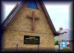
| Chiswick Methodist
Church is a modern
facility on the edge of Chiswick. By no means as
grand as the central Methodist church in Hammersmith
which is only a few minutes away by car, the church
is home to a small and friendly Christian
congregation. The church and its parishioners enjoy
being a central part of community life in Chiswick
and invest a great deal of time in social and
charitable activities.
|
 |
Sutton
Court Road, Chiswick, London W4 1TR Map CHISWICK METHODIST CHURCH CLICK |
||||||||||||||||||||||||||||||||||||||||||||||
|
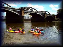
Chiswick Pier
Canoe Club
Based in a superb setting on the Thames at
Chiswick Pier, Chiswick Pier Canoe Club was formed in
1999 and has over 150 members. It is a friendly club
and new members are always welcome. The club has a
good spread of ages with many adult members and
youngsters from the age of 8.The club is very active
and a variety of disciplines are catered for including
touring, white water (freestyle, river running and
kayak surfing) and junior canoe polo - but we also
welcome people who just want to enjoy being on the
Thames . |
 |
The
Pier House Corney Reach Way London W4 2UG CHISWICK PIER CANOE CLUB CLICK |
Tel:
07933 276 792 |
|||||||||||||||||||||||||||||||||||||||||||||
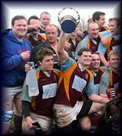
| Chiswick Rugby
Football Club are based
in Chiswick, Central London near Acton, Barnes and
Hammersmith. As always we are recruiting new players
of all levels.
|
 |
Riverside
Lands Dukes Meadows Chiswick London W4 2SH map CHISWICK RFC CLICK |
tel
:
07973 268 392 |
|||||||||||||||||||||||||||||||||||||||||||||
| Chiswick Town Hall is a
popular location for antique and collectors fairs
and is located in Heathfield Terrace just off
Chiswick High Road. Bus routes 27, 237, 267, 391,
E3, H40 and H91 stop within 1 or 2 minutes walk.
Chiswick Park tube station is about 5 minutes walk
away and Gunnesbury station is within a 10 minute
walk. Car parking around the hall is on meters.
|
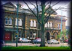 |
Heathfield
Terrace,
Chiswick,
London W4 4JN Map CHISWICK TOWN HALL CLICK |
tel:
0208 5834456 |
|||||||||||||||||||||||||||||||||||||||||||||
| Cygnet Rowing Club Cygnet RC is
affiliated to the Civil Service Sports Council. More
information can be found at its Main
and London sites.
|
 |
Civil
Service Boathouse Dukes Meadows, Chiswick London W4 2SH CYGNET ROWING CLUB CLICK |
tel
:020 8994 0025 |
|||||||||||||||||||||||||||||||||||||||||||||
| Dukes Meadows
Trust is a
community driven conservation charity working to
restore a riverside park on the Thames at Chiswick.
We aim to improve the leisure potential and bio
diversity of the park by involving volunteers from
across the community.
|
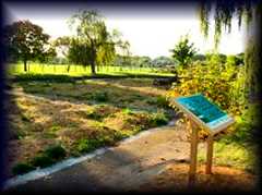 |
Dukes
Meadows Trust
Registered
OfficeThe Pavilion Market Drive Chiswick London W4 2RX DUKES MEADOW CLICK |
Phone +44 (0) 20 8742 2225 | |||||||||||||||||||||||||||||||||||||||||||||
| The Fullers
Brewery has been
part of life in Chiswick for well over a century.
The UK's largest independent brewer of ales, Fullers
has gained a great reputation around the world for
its products. The brewery is open for public tours
of the facility which offers a fascinating insight
into the process of beer making and marketing from
the hops arriving at the building to the designed
bottles leaving at the other end.
|
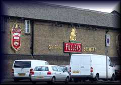 |
Griffin
Brewery,
Chiswick
Lane South, Chiswick, London W4 2QB Map FULLERS BREWERY CLICK |
tel:+44
(0)20
8996
2000 fax: +44 (0)20 8995 0230 |
|||||||||||||||||||||||||||||||||||||||||||||
|
Quinton Boat
Club
Formed in 1907,
Quintin Boat Club is open to all and seeks to
encourage all levels of rowing ability from elite
athletes to beginners. It is situated at the
University of Westminster Boathouse, close to
Chiswick Bridge in West London. New members are
welcome. If you are interested, take a look at our .
|
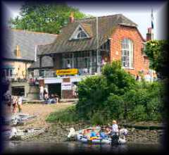 |
Quintin
Boat Club The University Boathouse Ibis Lane Chiswick London W4 3UJ QUINTON BOAT CLUB CLICK |
Phone + 44 (0)20 8994 3715 |
|||||||||||||||||||||||||||||||||||||||||||||
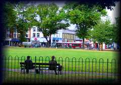
| Turnham Green is one of the
central parks of the suburb of Chiswick in west
London. For centuries the area has been used as a
place of trading and a place of meeting for the
local people. Today the facility is primarily used
as a recreation ground, locals and visitors alike
playing sports, walking dogs or simply sitting
contemplating and watching the world go by.
|
 |
Chiswick,
London
W4
1LN Map TURNHAM GREEN BATTLEFIELD CLICK |
||||||||||||||||||||||||||||||||||||||||||||||
| Ealing The Saxon name
for Ealing was recorded c.700 as 'Gillingas',
meaning 'place of the people associated with Gilla',
from the personal name Gilla and the Old English
suffix '-ingas', meaning 'people of'. Over the
centuries, the name has changed, and has been known
as Yealing, Zelling and Eling, until Ealing became
the standard spelling in the 19th century.
Archaeological evidence shows that parts of Ealing have been occupied for at least 7,000 years. Iron Age pots have been discovered in the vicinity on Horsenden Hill. A settlement is recorded here in the 12th century amid a great forest that carpeted the area to the west of London. The earliest surviving English census is that for Ealing in 1599. This list was a tally of all 85 households in Ealing village giving the names of the inhabitants, together with their ages, relationships and occupations. It survives in manuscript form in the Public Record Office (PRO E 163/24/35), and has been transcribed and printed by K J Allison. Settlements were scattered throughout the parish. Many of them were along what is now called St. Mary's Road, near to the church in the centre of the parish. There were also houses at Little Ealing, Ealing Dean, Haven Green, Drayton Green and Castlebar Hill.The Church of St. Mary's, the parish church, dates back to the early twelfth century. The parish of Ealing was divided into manors, such as those of Gunnersbury and Pitshanger. These were farmed; the crops being mostly wheat, but also barley and rye. There were also animals such as cows, sheep and chickens. It was during the Victorian period that Ealing became a town. This meant that roads had to be built, drainage provided, and schools & public buildings erected. The man responsible for much of all this was Charles Jones, Borough Surveyor from 1863–1913. He planted the horse chestnut trees on Ealing Common and designed the Town Hall, both the present one and the older structure which is now a bank (on the Mall). Ealing Broadway became a major shopping centre. It was in 1901 that Ealing Urban District was incorporated as a municipal borough, Walpole Park was opened and the first electric trams ran along the Uxbridge Road — a mode of transport that Transport for London (TFL) tried to reintroduce some 110 years later in the form of the West London Tram scheme. This was abandoned in August 2007 in the face of fierce local opposition and a switch in priorities and funding to Crossrail. The building of a new shopping centre, which opened in 1984, drastically altered the centre of Ealing. |
||||||||||||||||||||||||||||||||||||||||||||||||
|
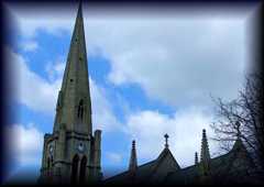
Christ the
Saviour Church
is one of the iconic symbols of Ealing Broadway
in west London. The magnifies parish church towers
above the rows of shopping streets below and acts as a
perfect contrast to the modern developments that have
taken place around it. The church is a friendly
congregation with an eclectic mix of parishioners
reflecting the diverse nature of the populous in
Ealing and surrounding suburbs. The church spire is
one of the highest in west London and is visible from
miles around. |
 |
Phone: +44 (0)20 8567 1288 | ||||||||||||||||||||||||||||||||||||||||||||||
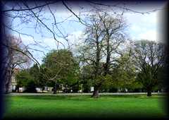
| Ealing Common is a large
piece of grass and woodland on the edge of the leafy
and affluent west London borough of Ealing. The
common has been a place of recreation and retreat
for the people of the area for centuries and today
still attracts large numbers of visitors when the
weather is fine. The common is use for sporting
events, running, walking and cycling as well as
several large open-air festivals at the height of
summer.
|
 |
Ealing,
London W5 Map |
||||||||||||||||||||||||||||||||||||||||||||||
EALING KOSHER FOOD Click
here for Kosher Eateries
|
||||||||||||||||||||||||||||||||||||||||||||||||
| Ealing Local
History Centre Ealing
is
a
large borough of West London and has a fascinating
history that is inexorably connected to the people
and events of the capital. This museum studies the
heritage of the local people and attempts to chart
the development and growth of the borough from the
earliest signs of human settlement right through
until today. The collection is open to the public
throughout the year and is popular with school
parties.
|
Phone: +44 (0)20 8825 8194 | |||||||||||||||||||||||||||||||||||||||||||||||
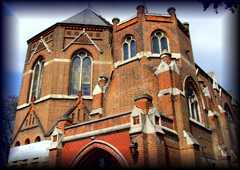
| Haven Green
Baptist Church stands
proudly on the corner of the large parkland area of
Haven Green. The church is magnificent in its design
and although not ancient has certainly been spared
no attention t detail during its construction in the
19th Century. The building within is even more
spectacular than outside and is home to a great deal
of wonderfully crafted artefacts. The congregation
is eclectic and extremely welcoming to newcomers.
|
 |
Phone: +44 (0)20 8998 2508 - Fax: +44 (0)20 8810 9847 | ||||||||||||||||||||||||||||||||||||||||||||||
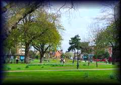
|
Havers Green
is a
beautiful parkland area immediately behind Ealing
Broadway on the edge of the leafy suburb. The
green has facilities for playing sports, but is
primarily used as a place for people to sit and
relax on a summer’s day. It is a particularly
popular spot with many of the shop workers who can
escape from the busy streets of the Broadway for
an hour during lunch. The green is intersected by
a road but is still relatively tranquil compared
to most of the surrounding area.
|
 |
Ealing,
London W5 Map |
||||||||||||||||||||||||||||||||||||||||||||||
| PM Gallery is one of the
most important cultural venues in Ealing, and this
charming house is the perfect location for such a
prestigious place. The house was constructed by John
Soane in 1800 and contains a contemporary arts venue
and permanent gallery. The London Borough of Ealing
holds the largest collection of Martinware in the
country, donated by the Hull Grundy family in 1980,
and is housed here.
|
Walpole Park,
Mattock Lane, Ealing, London W5 5EQ
Map |
Phone: +44 (0)20 8567 1227 - Fax: +44 (0)20 8567 0595 | ||||||||||||||||||||||||||||||||||||||||||||||
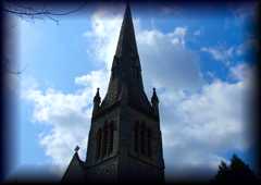
| Polish Roman
Catholic Church of Our Lady Mother of the Church This
magnificent church stands just a few streets off
Ealing Broadway in the west of London. It is one of
very few Polish Catholic Churches in the United
Kingdom but was built to accommodate the huge number
of Polish immigrants who came to the west of London,
particularly Ealing and Acton, during and
immediately after the Second World War. The church
is open to all nationalities and has a friendly and
welcoming atmosphere.
|
 |
Phone: +44 (0)20 8567 1746 - Fax: +44 (0)20 8810 0185 | ||||||||||||||||||||||||||||||||||||||||||||||
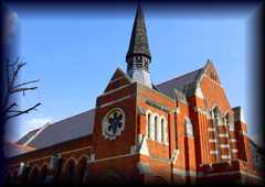
| St. Andrews United
Reform Church This
magnificent church is located close to the centre of
Ealing in west London. The building is a fine
example of its type of neo-modern ecclesiastical
architecture. The church has a great deal of
interesting artefacts within including some lovely
hand crafted wood pieces and interesting stained
glass panels. The congregation is large and
eclectic, always welcoming new members.
|
 |
|||||||||||||||||||||||||||||||||||||||||||||||
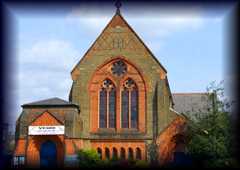
| St. Matthew’s
Church This church was
constructed in the early 20th century to accommodate
the ever-growing need for a place of worship in the
expanding residential districts around Ealing
Common. Beautifully crafted, the church is built in
a neo-gothic style and fits in well to the leafy
streets that surround it. The church is home to a
lively Christian congregation who come from many
different backgrounds, classes and races to meet and
worship on the site.
|
 |
North
Common Road, Ealing Common, London W5 2QA Map |
||||||||||||||||||||||||||||||||||||||||||||||
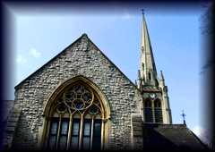
| St. Stephen’s
Church is Ealing’s
best-kept secret. Tucked away at the top of a hill
in west Ealing, the church and centre are hidden
from view by a great deal of residential housing
from most angles. However when you do see the church
you are awed by its magnificent architecture and
wonderful attention to detail. The church is a
lively and active Christian community that has
special sessions for men, women and young people.
The church centre across the road is used for many
community events.
|
 |
Phone: +44 (0)20 8991 0164 - Fax: +44 (0)870 1374209 | ||||||||||||||||||||||||||||||||||||||||||||||
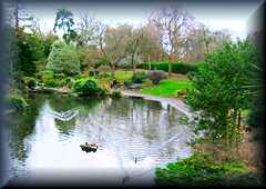
| Walpole Park This popular
Park was originally the gardens of Pitzhanger Manor.
Much of the original 1804 landscaping has been
retained including a walled rose garden, tree lined
avenues and several ornamental ponds, although the
largest section of the park is a large, open space
ideal for sports and games. More recently a
children's playground and a refreshments booth have
been added. In the Summer the park fills up with
visitors for a series of music and comedy festivals.
|
 |
Mattock Lane, London
W5 5EQ
|
Phone: +44 (0)20 8566 1929 | |||||||||||||||||||||||||||||||||||||||||||||
| Edgware Edgware was an
ancient hamlet in the county of Middlesex. Edgware
is a Saxon name meaning Ecgi's weir. Ecgi was a
Saxon and the weir relates to a pond where Ecgi's
people would catch fish. The Edgware parish formed
part of Hendon Rural District from 1894. It
was abolished in 1931 and formed part of the
Municipal Borough of Hendon until 1965. The
Romans made pottery at Brockley Hill, and is thought
by some to be the site of Sulloniacis. Canons Park,
to the north-west, was developed as an estate by
James Brydges, 1st Duke of Chandos and was the site
of his great palace Cannons. Most of Edgware is in
the London Borough of Barnet, but the western part
is in the London Borough of Harrow and the
Queensbury area is in the London Borough of Brent.
The three boroughs meet at the junction of Burnt Oak
Broadway and Stag Lane.
It is principally a shopping and residential area and is known by those who regularly use the London Underground as being one of the northern termini of the Northern Line. It has a bus garage, a shopping centre called The Mall, a library, a large hospital, Edgware Community Hospital, and two streams, Edgware Brook and Deans Brook, which are tributaries of the Silk Stream, which in turn merges with the River Brent at the Welsh Harp (Brent Reservoir). Edgware is outside the London postal district and instead forms a separate post town in the HA postcode area. In the 2001 Census, 36.9% of Edgware residents give their religion as Jewish, 28% Christian, 9% Hindu and 5% Muslim. The Jewish community in Edgware has constructed its own Eruv. |
||||||||||||||||||||||||||||||||||||||||||||||||
| Canon Sports
Centre |
North London Colelgiate School, Dalkeith Grove, Edgware, HA8 7RJ | tel: 020 8951 5402 | ||||||||||||||||||||||||||||||||||||||||||||||
Edgware Kosher Food Click
here for Kosher Eateries
|
||||||||||||||||||||||||||||||||||||||||||||||||
| Edmonton Edmonton was a
local government district in south east Middlesex,
England from 1850 to 1965.Edmonton local board was
formed in 1850 for the parish of Edmonton All
Saints. In 1881 Southgate was separated from the
Edmonton local board's district, forming its own
local board.[1] Edmonton became an urban district in
1894 under the Local Government Act of that year. In
1937 the urban district was granted a charter of
incorporation as a municipal borough. In 1965 the
municipal borough was abolished and its former area
transferred to Greater London to be combined with
that of other districts to form the London Borough
of Enfield.
|
||||||||||||||||||||||||||||||||||||||||||||||||
| Millfield Theatre | Millfield Theatre, Silver
Street, Edmonton, London, N18 1PJ MILLFIELD THEATRE CLICK |
|||||||||||||||||||||||||||||||||||||||||||||||
| Enfield Enfield was
recorded in the Domesday Book 1086 as Enefelde,
Einefeld 1214, Enfeld 1293, Enfild 1564, that is
'open land of a man called Ēana, or where lambs
are reared', from the Old English feld with an Old
English personal name or with Old English ēan
'lamb'. The feld would have been a reference to an
area cleared of trees within woodland later to
become Enfield Chase. Enfield Town used to be a
small market town on the edge of the forest about
a day's travel north of London. As Greater London
has grown, Enfield Town and its surrounds have
become a residential suburb, with fast transport
links into central London.The current borough was
formed in 1965 from the former area of the
Municipal Borough of Southgate, the Municipal
Borough of Enfield and the Municipal Borough of
Edmonton. The armorial bearings of these three
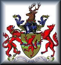
boroughs were also merged.The creature on the
shield of the Enfield coat of arms is known in
heraldry as an "Enfield" (or colloquially as the
Enfield beast), and is used extensively as a logo
representing Enfield, particularly by the borough
council.In Roman times, Enfield was connected to
Londinium by Ermine Street, the great Roman road
which stretched all the way up to York. Artefacts
found in the early 1900s reveal that there were
Roman settlements in the areas that are now
Edmonton and Bush Hill Park. In 790 King Offa was
recorded as giving the lands of Edmonton to St
Albans Abbey. The area became strategically
important as East Anglia was taken over by the
Danes. In the 790s strongholds were built by men
loyal to King Alfred the Great, in order to keep
the Danes to the east of the River Lea.After the
Norman Conquest, both Enfield and Edmonton were
mentioned in the Domesday Book. Both have
churches, and Enfield has 400 inhabitants,
Edmonton 300. Enfield is also described as having
a "parc". This parc—a heavily forested area for
hunting—was key to Enfield's existence in the
Middle Ages (see Enfield Old Park). Wealthy
Londoners came to Enfield first to hunt, and then
to build houses in the green, wooded surroundings.
In 1303, Edward I of England granted Enfield a
charter to hold a weekly market, which has
continued up to this day.
|
 |
|||||||||||||||||||||||||||||||||||||||||||||||
|
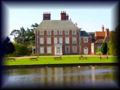
Forty Hall Museum
is located at
the heart of Enfield and is dedicated to the
development and history of this community.
Although to many in the modern age, Enfield may
not look particularly historic, one would be
surprised by the amount of fascinating history
that lies beneath the streets. Much of this is
explored in this celebrated collection, filled
with artefacts and documents that bring the past
to life.
|
 |
Phone: +44 (0)20 8363 8196 - Fax: +44 (0)20 8367 9098 | ||||||||||||||||||||||||||||||||||||||||||||||
|
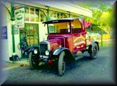
Whitewebbs
Museum Of Transport
Come
along on a Tuesday afternoon between 10 a.m. and 4
p.m. (last entry 3.30 p.m.). Our entry fee is
£3.00 for adults and accompanied children under 12
are FREE. Enjoy a cup of tea, coffee or light
refreshments while you relax in our meeting room.
We also cater for school groups and organised private groups by prior arrangement. Please contact the museum office for further details. Visit our “Contact Us” page for the relevant information. |
 |
Whitewebbs
Road,
Enfield,
Middlesex EN2 9HW WHITEWEBBS MUSEUM CLICK |
tel: (020) 83671898 | |||||||||||||||||||||||||||||||||||||||||||||
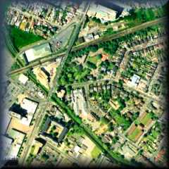
| Feltham Feltham formed an
ancient parish in the Spelthorne hundred of
Middlesex. In 1831 it occupied an area of
2,620 acres and had a population of
924. From 1894 to 1904 the Felham parish
was included in the Staines Rural
District. In 1901 the parish had a
population of 4,534 and in 1904 it was
split from the rural district to form the
Feltham Urban District. . In 1932 the parishes
of Hanworth and East Bedfont were also
transferred from the Staines district to the
council of Feltham Urban District. The former
area of Feltham Urban District became part of
Greater London in 1965 as part of the London
Borough of Hounslow. In 1784 General William Roy
set out the baseline of what would become the
Ordnance Survey across Hounslow Heath, passing
through Feltham. General Roy is commemorated by
a local pub. The MOD Defence Geographic Centre
still has a base in Feltham.The main economic
activity of the Feltham area was market
gardening until well into the twentieth century.
A popular variety of pea is known as "Feltham
First" as it was first grown in the town. The
market gardens were largely replaced with light
industry and new housing from the 1930s onwards,
but this is still one of the greenest areas in
Greater London and includes three rivers, part
of the once vast Hounslow Heath, a country park
formed from converted gravel pits, and one of
London's first airfields,London Air Park, which
is now a large and popular public open space.
|
 |
British History Online - Spelthorne Hundred - Feltham. (1911) | ||||||||||||||||||||||||||||||||||||||||||||||
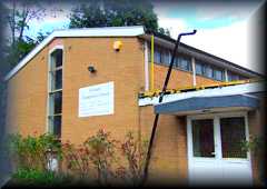
| Feltham
Evangelical Church Feltham
Evangelical Church is a small modern church facility
on the edge of Feltham in west London. The church is
home to a small but committed Christian congregation
who meet there on a regular basis to take part in
prayer and to organise activities for the community
of a charitable and social nature. New members are
always welcome.
|
 |
Manor
Lane, Feltham, London TW13 Map |
||||||||||||||||||||||||||||||||||||||||||||||
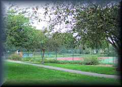
| Feltham Park
is the largest
green area of public land in the west London suburb
of Feltham. The park has been an historic place of
rest and relaxation for the people of the borough
for many generations. The park has several well
maintained sports pitches for organised and casual
games as well as a set of tennis courts and a large
children's playground.
|
 |
Feltham,
London TW14 Map |
||||||||||||||||||||||||||||||||||||||||||||||
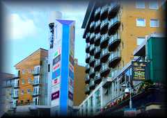
| Feltham Shopping
Centre Come to Feltham
Shopping Centre, often referred to as just "The
Centre", and explore our large array of shops here
in west London. We have a huge variety of popular
shops all under one roof, and a good range of
smaller local independent retailers. Ample eating
and drinking facilities are on hand should you
require a little refreshment whilst on your shopping
spree!
|
 |
Feltham,
London
TW13
4BH Map |
Phone: +44 (0)20 88442468 | |||||||||||||||||||||||||||||||||||||||||||||
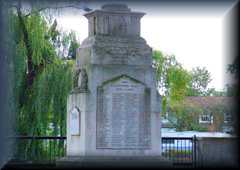
| Feltham War
Memorial Feltham War
Memorial is an understated and simple monument to
those men from the suburb who have given their lives
in conflict to help defend the basic rights that we
take for granted. Many hundreds of people from the
borough died in the First and Second World wars and
this monument not only commemorates their loss but
celebrates their outstanding bravery.
|
 |
The
Green, Feltham, London TW13 Map |
||||||||||||||||||||||||||||||||||||||||||||||
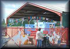
| Hounslow Urban
Farm is located just
outside Hounslow in Feltham, a suburb of west London
close to Heathrow Airport. The farm is the largest
city farm in London covering 29 acres of land. It
offers local people and city dwellers the chance to
have close contact with a wide variety of wild
animals that they would otherwise have no experience
of in their urban lives.
|
 |
Faggs Road, Feltham,
London TW14 0LZ
|
Phone: +44 (0)20 8751 0850 | |||||||||||||||||||||||||||||||||||||||||||||
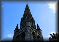
| St. Catherine's
Church St. Catherine's
is one of the finest looking churches in Feltham, a
suburb of west London. The beautiful building
positioned on the eastern edge of the town is close
to the river and the railway tracks. The church has
a long and interesting history associated with the
area and is home to a large and friendly Christian
congregation who regularly meet there for prayer.
|
 |
High
Street, Feltham, London TW13 Map |
||||||||||||||||||||||||||||||||||||||||||||||
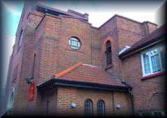
| St. Lawrence's
Church St. Lawrence's
Roman Catholic Church is situated in a delightful
position on the edge of Feltham Green in the centre
of the west London suburb. The church towers above
most of the residential and commercial buildings
around it and serves as a beautiful monument to
Christianity. The church has a large and committed
Christian congregation who come from across the
world.
|
 |
9 The
Green, Feltham, London TW13 4AF Map |
||||||||||||||||||||||||||||||||||||||||||||||
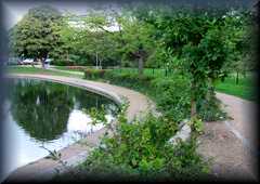
| The Green The Green is an
ancient piece of public land at the very heart of
Feltham in west London. This area would have once
been the town green before Feltham was swallowed up
into the larger conurbation of Greater London. It
features a duck pond and a series of beautifully
landscaped gardens that attract locals and visitors
alike all year round to sit, relax and watch the
world go by.
|
 |
High
Street, Feltham, London TW13 Map |
||||||||||||||||||||||||||||||||||||||||||||||
|
The
Bishops Avenue, which connects Hampstead Heath to
East Finchley, is one of the most exclusive
addresses in the UK. Often called "Billionaires'
Row", its houses are some of the most expensive in
the world (some have sold for over £40 million!) Finchley was twinned with the town of Jinja in Uganda in 1963, a year after Uganda won self-rule—the link was probably established to help the process. Harry Beck, the man who transformed the convoluted map of the London Underground into the vastly simplified version seen the world over today, lived near Finchley Central Tube station. There's a galaxy of stars who hail from Finchley. David Jason, Spike Milligan, Eric Morecambe, George Michael, Peter Sellers and Spice Girl Emma Bunton, to name but a few, all have their roots here. Infamous chat show host Jerry Springer was born in East Finchley Tube station during World War II after his family fled the Holocaust. The Phoenix cinema in East Finchley is believed to be the oldest purpose-built, continuously running cinema in the country. It opened in 1910, although back then it was called "The East Finchley Picturedrome" Finchley Manor, now called the Sternberg Centre, is the largest Jewish cultural centre in Europe. In 2007, East Finchley cemetery was named "Cemetery of the Year". People are dying to be buried there. Finchley is first mentioned in the 13th century. The "ley" end to the word suggests an opening in woodland but whether the "Finch" refers to a bird or a person called Finch has been lost in the mists of time. Finchley has an active local arts scene which is publicised by Barnet Borough Arts Council. The Arts Depot at Tally Ho Corner North Finchley opened in Autumn 2004. Finchley has two active orchestras and two choirs. The principal orchestra is the Finchley Chamber Orchestra FCO, conducted by David Lardi. The other community orchestra is the Tudor Orchestra; both orchestras rehearse at Trinity Church Centre N12 7NN, close to the Tally Ho bus terminus, the FCO on Thursday nights and the Tudor Orchestra on Monday nights. The two choirs are the Finchley Chamber Choir (FCC) FCC, again conducted by David Lardi, and the larger Finchley Choral Society conducted by Grace Rossiter. The FCC also rehearses at the Trinity Church Centre (Tuesday evenings) whilst The Finchley Choral Society FCS rehearses at Moss Hall School, Nether Street, West Finchley, N3 1NR, on Monday nights. |
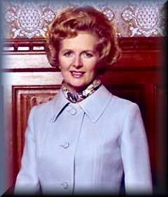 Between 1959 and 1992, Finchley was the UK parliamentary constituency of one Margaret Thatcher. The Ladies of Finchley At the southern edge of Finchley is a 5 m (16 ft) high bronze statue of a naked woman holding a sword above her head. It was originally planned as one of 11 identical statues made in 1919 to be donated to Belgian or French cities occupied or destroyed during World War I. Daily Mail proprietor Lord Rothermere bought one of them and donated it to Finchley Council. 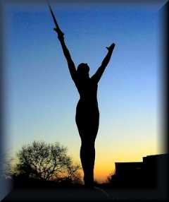 |
London Borough of Barnet North London Business Park (NLBP), Oakleigh Road South, London. N11 1NP first.contact@barnet.gov.uk www.barnet.gov.uk The Guild Players are Finchley's amateur drama group, based at Finchley Methodist Church in Ballards Lane. Finchley Cinevideo Society (FCS) is one of the country's oldest film making clubs - founded in 1930. It still meets weekly in North Finchley. Finchley Games Club meets every Thursday evening to play board games, role-playing, collectible card games, etc. There is also a FinchleyFCMG Children's Music Group (youth choir) . |
tel:020 8359 2000 | |||||||||||||||||||||||||||||||||||||||||||||
|
All Saints'
Church
is an Anglican community where
the Catholic Faith is taught and practised. The
sacraments of the One, Holy, Catholic and
Apostolic Church are authentically celebrated to
the glory of God by validly ordained priests
and bishops. We praise God in the
beauty of holiness and rejoice in
the traditions of the Catholic
Church. All Saints' Church is served
by priests of the Society of the
Holy Cross |
 |
Twyford Avenue London N2 9NH ALL SAINTS CLICK |
tel:
020 8883 9315 |
|||||||||||||||||||||||||||||||||||||||||||||
| Arts Depot North London's
latest arts centre is a stylish and exciting venue
offering a vibrant and dynamic programme of events
in its unique, state-of-the-art performance and
gallery spaces.artsdepot offers a
broad range of theatre, comedy, dance, music, spoken
word and visual art; so whether you're looking for
children's shows, comedy gigs, West End success
stories or a stint of Flamenco dance, knitting or
acting from our extensive range of children's
courses and classes, artsdepot definitely has
something for you.artsdepot is based
at the heart of North Finchley's town centre,
sitting alongside health & leisure facilities,
restaurants, bars and shops. There is also a cafe
and bar within the new 4-storey building, providing
a comfortable and relaxing place to enjoy a drink, a
snack or an evening meal.
|
 |
ARTS DEPOT CLICK |
tel : 020 8369 5454 |
|||||||||||||||||||||||||||||||||||||||||||||
| Bishops Avenue An
ultra-exclusive street running from the northern tip
of Hampstead Heath to East Finchley. Neighbouring
Winnington Road is almost as well-heeled. Highgate
golf course lies to the east and Hampstead Garden
Suburb to the west. The name derives from the
bishops of London, who owned a large hunting park in
the area in the late Middle Ages. This is probably
the most ‘desirable’ address outside central London,
if you like ostentatious displays of wealth. One
house, the Towers, sold for around £10 million in
1992 – a phenomenal price at that time. Its features
include an island with palm trees in the middle of
its indoor swimming pool. Another, the
twelve-bedroom, eleven-bathroom Summer Palace, was
built in 1991. It has a brass and crystal glass
lift, a comprehensive leisure complex and a central
atrium. It is presently owned by the steel baron
Lakshmi Mittal but is not his main place of
residence in London. Prices on the avenue have
continued to spiral and Toprak Mansion was sold in
January 2008 to the Kazakhstani billionairess
Horelma Peramam for £50 million. The house had been
nicknamed Top Whack Mansion but, according to the
Times, it will now be known as Royal Mansion. The
council has taken exception to some of the most
vulgar monstrosities that have been put up here in
the last decade or two, but realistically the avenue
is beyond redemption and should be allowed to
continue as an object of amazement and amusement.
However, London’s billionaires mostly prefer to live
in Kensington or Belgravia, so some properties have
lain empty in recent years and the latest trend is
for their replacement by high-price, low-rise
apartment blocks.
|
 |
|||||||||||||||||||||||||||||||||||||||||||||||
| College Farm The College
Farm Trust purchased the Farm at the end of 2006 and
their vision is to make College Farm a well
recognised, consistently used and accessible
educational and recreational resource for the people
and local communities in the North London area.The
Trust own the freehold and the Ower family have a
controlled agricultural tenancy, which they have
held since 1976, during which time they developed
the site into a rare breeds farm for the public to
enjoy, resulting in an annual attendance of over
30,000. However, this was brought to an end during
the foot and mouth period in 2001, but the Trust,
with close cooperation of the family hope to revive
those active and exciting days once again.
The Ower family run a successful shop on site which is North London's largest equestrian and pet store and this will be kept entirely separate from the farm development. The main buildings which are 125 years old are Grade II listed and the whole 10 acre site is a Conservation Area. Much repair is required and a large area of derelict buildings will have to be re-developed. It is hoped to obtain grants from various sources but in the mean time we are starting a local fund raising project. So please visit The fund raising section of the website for any up and coming events and for donations. Initially we intend to bring the main forecourt and the south facing elevation up to standard, improve the Tea House & the Toilets, build new poultry pens and buy chickens, ducks, rabbits, sheep and goats, with the intention of opening this area to the public by summer 2009, for the children to enjoy during their summer holiday. |
 |
Fitzalan
Road Finchley, London, N3 3PG COLLEGE FARM CLICK |
tel: 0208 349
0690 |
|||||||||||||||||||||||||||||||||||||||||||||
| David Lloyd
Finchley Not only does
David Lloyd Finchley offer first class gym
facilities, our tennis, swimming and leisure
facilities are also unbeatable in North London.
David Lloyd is the premier health and racquet club
in the UK and Finchley is a fantastic example of why
that's true. I'm Tracy Gale, General Manager of
David Lloyd Finchley and my friendly staff and I are
here to make your visits to David Lloyd a valuable
and enjoyable experience.
|
 |
Leisure
Way High Road Finchley London N12 0QZ DAVID LLOYD FINCHLEY CLICK |
tel: 020 8492 2250 | |||||||||||||||||||||||||||||||||||||||||||||
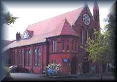
| East Finchley
Methodist Church EFM is a
vibrant church with much to offer the community in
which it sits. It is part of the Barnet and
Queensbury Circuit, which falls within the London
District of the Methodist Church. We invite you to
come and find out more about the people who call
themselves Methodists. You can be assured of a warm
welcome. East Finchley Methodist church is a
10 minute walk from East Finchley Underground
station (or take a 263 bus to save your legs!), at
the junction of East Finchley High Road with
Creighton Avenue . The church has its own
off-street parking and is fully accessible to people
with disabilities. The Sanctuary is the heart of the
church and is home to most of the Services. It is
equipped with an induction loop (those using hearing
aids should switch to the 'T' setting to benefit
from an amplified reproduction of the services), and
the sound system extends into the adjoining
Fellowship Room and Middle Room. We have a small
supply of large print Hymn Books. Seating in the
sanctuary is movable, allowing occasional services
to be held 'in the round' as well as in the more
traditional 'aisle and row' arrangement.
|
 |
197
High Road East Finchley London N2 8AJ EAST FINCHLEY METHODIST CHURCH CLICK email: info@eastfinchley methodist.org.uk |
||||||||||||||||||||||||||||||||||||||||||||||
| Finchley Central
Station Plaque to Harry Beck The first maps of the London
Underground showed how the Tube lines would appear
from above, if we could peel away the surface of the
city and look beneath the streets. These were
difficult to use, with interweaving lines resembling
a plate of spaghetti. Then, in 1931, Harry Beck, a
young draughtsman in the signalling department of
London Transport, had a wonderful idea. Beck
realised that when you're on a train travelling
underground, your geographical location is not what
matters to you. The important thing is knowing how
to get to your final destination, and where to
change from one line to another. On his own
initiative, Beck used this idea to create a
revolutionary new kind of map, After his death,
Beck's work was finally recognised by London
Underground, which placed a commemorative plaque on
the southbound platform of his home station,
Finchley Central: "In memory of Harry Beck, the
originator of the distinctive London Underground
map, who lived near here and used the station
regularly. The map is used by millions daily, and
has become recognised as a classic world-wide."
|
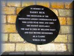 |
Finchley Central Station |
||||||||||||||||||||||||||||||||||||||||||||||
Finchley Central Synagogue |
 |
Redbourne Avenue, Finchley, London, N3 2BS | Tel: 020 8346 1892 | |||||||||||||||||||||||||||||||||||||||||||||
| Finchley Cricket
Club Finchley
cricket club existed in 1832 and Finchley Amateurs
and Whetstone or Woodside club, which had been
founded by Joseph Baxendale in the grounds of his
house, by 1869. The three clubs were merged in 1872
and had absorbed others, such as Torrington Park
(1890), by 1894. Said to be one of the best
in north London by 1905, Finchley cricket
club played at Ballards Lane and Long Lane until it
acquired its pitch at East End Road by 1908.
|
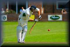 |
Arden Field
East End Road
FinchleyLondon N3 2TA FINCHLEY CRICKET CLUB CLICK |
Tel: 020 8346 1822 | |||||||||||||||||||||||||||||||||||||||||||||
| Finchley
Foil Fencing Club |
Pursall Road, Mill Hill, Barnet, London, NW7 2BU | |||||||||||||||||||||||||||||||||||||||||||||||
| Finchley Manor
Squash Club Squash has been
played at Finchley Manor since the late '60s. Since
then all our courts and changing facilities have
been upgraded and modernised. Today we have four
first-class courts, modern changing rooms, regular
club nights, active ladder leagues and a large and
growing membership. Squash at Finchley Manor shares
facilities with a large and vibrant Tennis section,
and the club has a gymnasium as well as a fully
licensed bar. The club has been in North London for
a long time: it was founded as a tennis club in 1881
and then in the 1960's two squash courts were built,
later increased to four as the squash boom took off.
Since then the club has expanded further, converting
nine grass tennis courts to all-weather surfaces in
the 1980's, adding a gym section in the 1990's and
increasing social activity generally over these
years with bigger and better bar facilities. We also
have a full-time manager, Lisa Smith, to oversee and
cater for a growing membership.
|
 |
Lyndhurst Gardens, Finchley, London, N3 1TD FINCHLEY MANOR CLICK |
tel:
0208 346 1327 |
|||||||||||||||||||||||||||||||||||||||||||||
| Finchley Golf Club Designed by
five-times Open winner James Braid, this, 18-hole,
6,356 yard, par 72 picturesque parkland golf course
is regarded as the finest challenge in North
London. Beautiful Victorian club house. Easy
access to central London, by car and tube. Visitors
welcome both during the week and at weekends.
|
 |
Nether Court, Frith Lane, Mill Hill, London, NW7 1PU FINCHLEY GOLF CLUB CLICK |
tel: 020 8346 2436 | |||||||||||||||||||||||||||||||||||||||||||||
FINCHLEY KOSHER FOOD Click here for
Kosher Eateries
|
||||||||||||||||||||||||||||||||||||||||||||||||
| Finchley Lido
Leisure Centre Finchley Lido
is one of those lidos considered under threat but
this summer the chilly outdoor pool will open for
weekends from Saturday 14th June until the end of
August (hopefully) - best to check with the Lido
before going. At the leisure centre next door there
is also a heated indoor pool, a modern fitness
centre, exercise classes and fitness programmes. If
you're after a more relaxed afternoon and the aim is
to escape the summer heat, the outdoor pool is the
place to be. The poolside terraces make an inviting
spot to lay down your towel, lie flat out and soak
up some glorious sunshine. The original 1930s
outdoor pool which sadly no longer exists was
enclosed by an elegant colonnade of Roman Doric
columns, with fountains to either side and was used
in the 1948 Olympic Games for men's water polo.
Today, the outdoor pool is a much smaller affair but
still, when the mercury rises, you'll be thankful
you made the trip to this little oasis.
|
 |
Unit 4 Great North Leisure Park Chaplin Square North Finchley London N12 0GL FINCHLEY LIDO CLICK |
Tel: 020 8343 9830 | |||||||||||||||||||||||||||||||||||||||||||||
| Finchley
Progressive Synagogue Our community
is an inclusive and welcoming Liberal
synagogue. We greet everyone who walks through
our doors with the extended hand of friendship and
the opportunity to experience real, living
community. We welcome all people seeking to live
Jewish lives, regardless of gender or sexual
orientation and partners of whatever religion are
made to feel at home. We value meaningful worship,
inspiring educational opportunities and a commitment
to social action.Liberal Judaism is the dynamic,
cutting edge of modern Judaism. Liberal Judaism
reverences Jewish tradition, and seeks to preserve
the values of the Judaism of the past while giving
them contemporary force. It aspires to a
Judaism that is always an active force for good in
the lives of Jewish individuals, families and
communities today, and equally makes its
contribution to the betterment of society. Liberal
Judaism is the Judaism of the past in the process of
becoming the Judaism of the future.
|
54 Hutton Grove London N12 8DR information@fps.org FINCHLEY PROGRESSIVE SYNAGOGUE CLICK |
Tel 020 8446 4063 FAX 020 8446 9599 |
||||||||||||||||||||||||||||||||||||||||||||||
|
Finchley Reform Synagogue , the "Tree of
Life" congregation, is a lively, friendly and caring
community. We are committed to celebrating Jewish
traditions and beliefs in a way that is meaningful
and relevant to modern life. Our ethos is based on:
* innovation,
* informality, * inclusivity. We
welcome all individuals, regardless of their Jewish
background or circumstances, and encourage members
to play a full role in the in the religious and
communal life of the synagogue. This includes
anything from leading services, helping community
members at times of difficulty, fundraising for
charities to taking part in a wide range of social
and educational events for all ages. There’s bound
to be something you will find rewarding and
fulfilling at FRS. FRS is a member of the Movement
for Reform Judaism and participates in many of its
activities. We are also active in the wider
community, with strong links to other faith
communities.
|
 |
101 Fallowcourt Avenue
North Finchley London N12 0BE Email:frs@frsonline.org FINCHLEY REFORM SYNAGOGUE CLICK |
Tel: 020 8446 3244 | |||||||||||||||||||||||||||||||||||||||||||||
| Finchley Rugby
Football Club The club was
founded in its present form on Monday 21 December
1925 under the chairmanship of AF Carris, who was
elected President, with RA "Johnny" Johnson as
Secretary. Although there are records showing that
Finchley Rugby Club was originated in 1875, this
cannot be confirmed as records are rather
sketchy.The first game the club played in its
present format was on 26 December 1925 against
Barnet Grammar School which the club won 18pts-6pts.
Since then this annual fixture was arranged with
Barnet Rugby Club until 1996 playing for the Brown
Bowler, which resides at Barnet RFC.The club's home
ground in 1925 was Arden Field, now Finchley Cricket
Club ground. In 1926-29 two pitches were obtained in
Colindale.The clubs original colours were sky blue
and thin black hoops, until 1930 when they changed
to a broad Scarlet and Grey hoop, these remained
until 1947 when the club adopted its present Scarlet
and White hoops.In 1929 the club moved to its
present ground in Summers Lane, in 1931 the 500 seat
stand was completed and the changing rooms and
clubhouse were housed underneath.
|
 |
Summers Lane, |
Tel: 020 8445 3746 | |||||||||||||||||||||||||||||||||||||||||||||
| Finchley Synagogue
Affectionately
known as Kinloss, we are a vibrant, warm and
friendly Orthodox community, inclusive of all Jews
and proud of the State of Israel. Our synagogue is a
haven for inspiring and enjoyable Synagogue
Services, a breathtaking range of creative
educational, cultural and social programmes and
personal support for the whole family.
|
 |
Kinloss
Gardens,
London, N3 3DU KINLOSS SYNAGOGUE CLICK |
Tel: 020 8346 855l | |||||||||||||||||||||||||||||||||||||||||||||
| Hollywood Bowl
Finchley Welcome to
hollywood bowl the UK’s number one tenpin bowling
experience.If you want to go tenpin bowling in the
UK then look no further than your local hollywood
bowl. Our aim is to give you and your party the
perfect bowling experience whether you are looking
for a kids party, an office event or to spend some
time out with friends.Founded over 15 years ago and
part of the Mitchells & Butlers portfolio of
leisure venues, hollywood bowl has a great track
record in providing top quality tenpin bowling. Our
well trained and helpful staff work with state of
the art facilities to ensure your visit is great fun
and safe. Each of our 24 tenpin bowling centres has
a minimum of 24 lanes, a licensed bar, a café and an
up to date games arcade area. This combination of
fun, facilities, staff and service makes hollywood
bowl an important choice when it comes to choosing a
leisure activity for a great time out.You can now
book online (available at all bowls soon) or by
calling your nearest hollywood bowl direct. We look
forward to looking after you and your party soon and
providing a striking and memorable time out!
|
 |
Great
North Leisure Park, Chaplin Square (Off Finchley High
Road), Finchley, London , N12 0GL HOLLYWOOD BOWL FINCHLEY CLICK |
Tel: 020 8446 6667 | |||||||||||||||||||||||||||||||||||||||||||||
| Jewish Museum In 1995 the
Jewish Museum relocated to an elegant, early
Victorian listed building in the vibrant
neighbourhood of Camden Town. In the same year it
amalgamated, on a two-site basis, with the former
London Museum of Jewish Life, in Finchley, North
London (now The Jewish Museum - Finchley).The London
Museum of Jewish Life was founded in 1983 as the
Museum of the Jewish East End, with the aim of
rescuing and preserving the disappearing heritage of
London's East End - the heartland of Jewish
settlement in Britain. While the East End has
remained an important focus, the Museum expanded to
reflect the diverse roots and social history of
Jewish people across London. It also developed an
acclaimed programme of Holocaust and anti-racist
education.
Opening hours: Monday - Thursday 10.30am-5pm, Sundays 10.30am-4.30pm Closed Friday, Saturday, Jewish Festivals, Public Holidays, 24 December - 4 January. The Museum is also closed on Sundays in August and Bank Holiday weekends. |
Sternberg
Centre 80 East End Road London N3 2SY Email: enquiries@jewishmuseum.org.uk Jewish Museum Web site |
Tel:
020 8349 1143 Fax: 020 8343 2162 |
||||||||||||||||||||||||||||||||||||||||||||||
| Middlesex County
Cricket School Come to The
Indoor School at Finchley and experience top quality
cricket coaching & practice Facilities. We cater
for groups, individuals, clubs, schools and cricket
parties. So, whether you are looking to hone your
technique for reaching the top or simply after
enjoyment, The Indoor School in Finchley is the
place to come! Middlesex CCC practice at the Indoor
School during the winter and when they are not
playing in the summer. The Indoor School is also the
base for the Middlesex Academy.
|
 |
East
End Road Finchley N3 2TA MIDDLESEX CCC SCHOOL CLICK |
Tel:
020 83468020 Fax 020 8349 1241 |
|||||||||||||||||||||||||||||||||||||||||||||
| North Finchley Vue
Cinema With 8 state of
the art auditoriums each with wall to ceiling
screens, air conditioning and Dolby surround sound
in each auditorium we offer an unforgettable visit
to our guests.
With ample free parking spaces our guests have no parking troubles. |
 |
Great
North Leisure Park, Chaplin Square London N12 0GL VUE CINEMA CLICK |
Tel: 0871 224 0240 | |||||||||||||||||||||||||||||||||||||||||||||
| Phoenix Cinema The Phoenix is
one of London's leading independent cinemas and one
of the oldest cinemas in the UK. Behind its modern
foyer lies an historic auditorium with unique art
deco features. The Phoenix has a renowned film
programme of new releases, independent,
foreign-language and specialist films, plus a
repertoire of old and new classics. It offers a kids
club, regular events, festivals, one-off talks and
screenings, workshops for schools, film classes and
a hugely popular membership scheme.
|
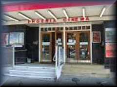 |
52
High Road, East Finchley, London, N2 9PJ PHOENIX CLICK |
tel: (0)20 8444 6789 | |||||||||||||||||||||||||||||||||||||||||||||
| St Mary - at -
Finchley. St Mary's has a
history of over 900 years service to the people as
the Parish Church of this area of North London.
Around 20 Minutes from central London by tube, we
are situated on Hendon Lane, just off Regent's Park
Road. Part of the Diocese of London within the
Church of England, we aim to be a lively and
generous community of faith, committed to the work
of the Gospel of Jesus Christ within the Modern
Liberal Catholic tradition of the Anglican Church.
Our building near to Finchley central station is
kept open each day during daylight hours, this
reflects our theology of openness and service to the
wider local community. If you should wish to visit
us in person we hope that you will find a warm
welcome and a stimulating home in this household of
faith, St Mary-at-Finchley.
|
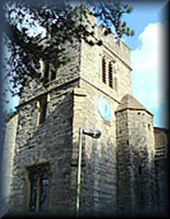 |
Hendon
Lane, Finchley, London, N3 1TS, FINCHLEY PARISH CHURCH CLICK |
Tel /
Fax: +44 (0) 20 8248 3818 |
|||||||||||||||||||||||||||||||||||||||||||||
| Victoria Park
Pentland Finchley Community Festival 10th, 11th and 12th July 2009 A New
Local Festival, Supporting Charities and Our Local
Community 3 DAYS OF COMMUNITY EVENTS Morris
Dancers - Scarecrow Competition - Animal Farm -
Vegetable & Flower Competitions - Country
Dancing - Dog Show - Tug of War - Egg & Spoon
Race - Hoola Hoop Competition - Punch &
Judy Shows - Face Painting - Family Entertainment
|
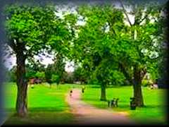 |
Victoria
Park,
Ballards
Lane, Finchley London N3 For all enquiries about the Festival email: info@ finchleycommunityfestival.co.uk FINCHLEY COMMUNITY FESTIVAL CLICK |
Tel: 01923 289890 | |||||||||||||||||||||||||||||||||||||||||||||
| Wingate &
Finchley Football Club Wingate Football
Club was founded in 1946 by four enthusiastic Jewish
sportsmen who returned to the U.K. after the Second
World War and wished to form a Jewish Football Club
playing in senior amateur competition. They
earnestly believed that one positive way of helping
to combat the ignorance and social evil of
anti-Semitism was on the field of play. Finchley
were the six oldest (substantiated) club in the UK.
They were founded in 1874 by NL “Pa” Jackson who
also founded the famous Corinthians, the London
Football Association, and who later became Secretary
of the FA. Finchley joined the London League from
the North London League in 1902.Early in 1991 it was
announced that the club would merge with Wingate and
a new club would participate in the South Midlands
League the following season
|
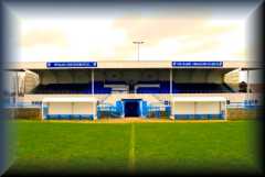 |
The
Harry Abrahams Stadium Summers Lane Finchley London N12 OPD Webmaster email: paul@wingatefinchley.com WINGATE & FINCHLEY FC CLICK |
Tel
: 020 8446 2217 or 0798 372 1449 Fax: 020 8343 8194 |
|||||||||||||||||||||||||||||||||||||||||||||
| Friern Barnet Friern Barnet
was an ancient parish in the Finsbury division of
Ossulstone hundred, in the county of Middlesex.
The area was originally considered to be part
of Barnet, most of which was in Hertfordshire. By
the thirteenth century the Middlesex section of
Barnet was known as "Little Barnet", before becoming
"Frerenbarnet" and then "Friern Barnet". The
"Friern" part of the parish's name, denotes
"brotherhood", and referred to its ownership by the
Priory of the Knights of the Hospital of St John of
Jerusalem Friern Barnet was mainly
rural until the nineteenth century. The opening of
Colney Hatch Hospital in 1851, and of railway
stations on the Great Northern and Metropolitan
Railways in the middle of the century began its
development as an outer London suburb. This process
was accelerated by the arrival of electric trams in
1909. Local affairs were
administered by the parish vestry until 1875, when
it was grouped with neighbouring parishes as part of
Barnet Rural Sanitary District. In response to a
petition by local ratepayers who wished the area to
be removed from the Barnet RSD, the parish adopted
the Local Government Act 1858 and formed a local
board of health of nine members in 1884. Under the
Local Government Act 1894 the local board's area
became an urban district. The urban district
occupied an area of 1,304 acres (5.28 km2) in 1911
and had a population of 14,924. In 1961 it occupied
an area of 1,342 acres (5.43 km2) and the population
was 28,813. In 1965 it became part of the London
Borough of Barnet.
|
||||||||||||||||||||||||||||||||||||||||||||||||
| Coppetts
Wood |
||||||||||||||||||||||||||||||||||||||||||||||||
| Friary Park |
||||||||||||||||||||||||||||||||||||||||||||||||
| North
Middlesex Golf Club |
||||||||||||||||||||||||||||||||||||||||||||||||
| Greenford | ||||||||||||||||||||||||||||||||||||||||||||||||
| London Motorcycle
Museum This is
London’s only museum that is entirely dedicated to
motorcycles. The collection starts with pieces that
were manufactured at the very beginning of the 20th
Century and works right through to the modern day.
There are over eighty full-sized cycles on display
as well as a range of associated memorabilia,
artefacts and photographs that help to tell the
story of the development of this machine in the
capital.
|
Ravenor
Farm,
Oldfield
Lane South, Greenford, London UB6 9LB Map E-mail London Motorcycle Museum London Motorcycle Museum Web site |
Phone:
+44
(0)208
575 6644 |
||||||||||||||||||||||||||||||||||||||||||||||
| Harrow Harrow was
formed in 1934 as an urban district of Middlesex by
the Middlesex Review Order 1934, as a merger of the
former area of Harrow on the Hill Urban District,
Hendon Rural District and Wealdstone Urban District.
The local authority was Harrow Urban District
Council. The urban district gained the status of
municipal borough on 4 May 1954 and the urban
district council became Harrow Borough Council. The
50th anniversary of the incorporation as a borough
was celebrated in April 2004, which included a visit
by Queen Elizabeth II. In 1965 the municipal borough
was abolished and its former area was transferred to
Greater London from Middlesex under the London
Government Act 1963 to form the London Borough of
Harrow. It is uniquely the only London borough to
replicate exactly the unchanged boundaries of a
single former district. This was probably because
its population was large enough. According to the
1961 census it had a population of 209 080, making
it the largest local government district in
Middlesex.Harrow is a diverse borough, having 55.2%
of its population from the BME (Black and Minority
Ethnic) communities, with the largest group being of
Indian ethnicity. Since 2005, Harrow Council
has held an annual multicultural music and
performance arts festival, Under One Sky. Harrow is
the most religiously diverse local authority area in
the UK, with a 62% chance that two random people are
from different religions, according to Office of
National Statistics, Oct 2006. It has the highest
density of Gujarati Hindus in the UK and
growing number of settlers from the African
continent, especially over 5000 households from
Somalia. There are also a lot of Irish and polish
people living in the borough. A large number of
Jewish people live in Stanmore and Hatch End.
|
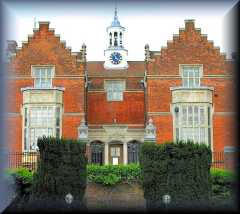 |
|
||||||||||||||||||||||||||||||||||||||||||||||
| Arts Culture Harrow A great venue with
great entertainment all year round and something
for all tastes and ages. The centre also manages a
medieval heritage site at Harrow Museum. Both
venues run workshops and courses and have a
changing programme of exhibitions.
|
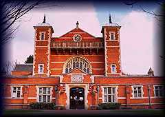 |
Harrow
Arts
Centre,
Uxbridge Road, Hatch End, Middlesex HA5 4EA
|
Phone: +44 (0)10 8428 0124 - Fax: +44 (0)20 8428 0121 | |||||||||||||||||||||||||||||||||||||||||||||
| Harrow Civic Centre
Library Harrow Civic Centre
Library is probably the most important cultural
building in the borough, and offers a place where
local people can come and exchange opinions as
well as indulge themselves in a top quality
collection of books and audiovisual material in
the library. One cannot help but be intrigued by
the local history section that holds a wealth of
information on the development of the community.
|
 |
Station Road, Harrow, London HA1 2UU Map HARROW LIBRARY CLICK |
Tel. (enquiries): 020 8424 1055 or 020 8424 1056 | |||||||||||||||||||||||||||||||||||||||||||||
| Harrow Museum Harrow Museum was
established in order to provide a permanent home
for the artefacts and documents that have been
collected with relation to the history of the
area, offering a safe environment where they can
be displayed and most importantly preserved for
the future. The museum tells the story, with
reference to these items, how the area has
developed and become part of the capital.
|
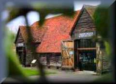 |
Pinner View, Harrow,
London HA2 6PX |
Phone: +44 (0)20 8861 2626 | |||||||||||||||||||||||||||||||||||||||||||||
| Old Speech Room Gallery
& Museum This old speech room
was built in 1821 as a chamber in which the boys
of the school and visiting guests could partake in
public speaking. It was converted into a gallery
in 1976 by Alan Irvine, and quickly became the
home of the schools significant art and history
collection. There are pieces on display that range
from the Roman and Egyptian times to artefacts
belonging to Winston Churchill.
|
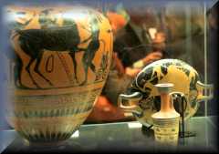 |
Harrow School
Harrow on the Hill Middlesex HA1 3HP |
Phone: +44 (0)20 8872 8205 - Fax: +44 (0)20 8423 3112 | |||||||||||||||||||||||||||||||||||||||||||||
HAYES & HARLINGTON |
||||||||||||||||||||||||||||||||||||||||||||||||
| HOUNSLOW |
||||||||||||||||||||||||||||||||||||||||||||||||
| |
||||||||||||||||||||||||||||||||||||||||||||||||
| HENDON Hendon was
historically a civil parish in the county of
Middlesex. The manor is described in Domesday
(1087), but the name, 'Hendun' meaning 'at the
highest hill', is earlier. There is even evidence of
Roman settlement discovered by the Hendon and
District Archaeological Society and others; an urn
burial of a headless child was found in nearby Sunny
Gardens Park. The Midland Railway and the Great
Northern Railways were built through Hendon in the
1860s .A socially graduated residential district
situated three miles north-west of Hampstead.
Excavations in 1974 revealed Roman remains from
c.AD300 but Hendon’s name (which means ‘at the high
down’) was first recorded in 959, when it was a
hamlet on the brow of Greyhound Hill. The ancient
manor and parish of Hendon covered over 8,000 acres,
mainly woodland that thrived on the heavy soil, with
small settlements in the clearings. The manor
belonged to Westminster Abbey from the 10th to the
16th century and, as the forest was cut down,
haymaking became the chief activity. The farmhouse
at Church Farm was built around 1660 and is now a
borough museum. During the 18th century, Brent
Street acquired several grand houses, along with the
Bell Inn and a cluster of shops around the junction
with Bell Lane. Hendon railway station was
originally called West Hendon when it opened in
1868. Modern Hendon took form during the late 19th
century as the hamlets around the station, Brent
Street and Church End began to coalesce. A distinct
social polarity emerged between the wealthy villas
in the Parson Street and Sunny Gardens area and the
working-class terraced houses further down the hill.
By the 1890s Brent Street had become Hendon’s main
shopping centre. Hendon Central station opened when
the London Underground extension to Edgware was
completed in 1923. Shortly afterwards came the
construction of the arterial roads that criss-cross
the district, bringing industry and new housing,
especially along the North Circular (A406). In 1931
Hendon was Britain’s most populous urban district.
The Hendon Technical Institute was established in
1939 and is now part of Middlesex University. During
the late 1950s and early 1960s the council pulled
down and rebuilt much of the housing stock,
preserving the social gradient that begins in the
disadvantaged lowlands of West Hendon and rises to
the comfortable undulations of Holders Hill. Thirty
per cent of the residents of the Hendon ward are
Jewish.
Unfortunately, much of the area developed into a suburb of London and now the area is mostly town with some countryside in the Mill Hill area, such as the Copthall Playing fields. Hendon big industry was mostly centred on manufacturing, and included motor and aviation works, and developed from the 1880s. In 1931 the civil parish of Edgware was abolished and its area was added to the great civil parish of Hendon. Hendon became an urban district in 1894. In 1932 the urban district became the Municipal Borough of Hendon. The municipal borough was abolished in 1965 and the area became part of the London Borough of Barnet. Hendon’s claim to fame is in flying and Hendon Aerodrome is now the RAF Museum. The area is closely associated with the aviator Claude Grahame-White. Another part of the Aerodrome site is the Hendon Police College, the training centre for the Metropolitan Police. It is a former borough and ancient parish. The name means the high place or down, and Hendon's motto is Endeavour. The Burroughs is a civic centre for the London Borough of Barnet, and also the site of Middlesex University Business School. |
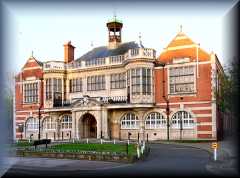 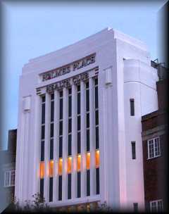 |
|
||||||||||||||||||||||||||||||||||||||||||||||
| Brent Cross
Shopping Centre Brent Cross
Shopping Centre brings the West End to North London,
attracting shoppers for miles around.
Brent Cross Shopping Centre was the UK’s first large enclosed shopping centre to be built in the UK back in 1976 with the revolutionary idea of late night opening and has since been extended and refurbished. Brent Cross offers more than 100 high street stores and designer stores, cafes and restaurants including John Lewis, Marks and Spencers, Boots, WHSmth, Dixons and Mothercare, with parking for 8,000 cars. Opening Hours: Monday to Friday 10am to 8pm Saturday 9am to 7pm Sunday 12noon to 6pm |
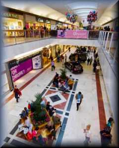 |
Brent
Cross
Shopping
Centre, Hendon, London, NW4 3FP BRENT CROSS CLICK |
tel: 020 8202 8095 | |||||||||||||||||||||||||||||||||||||||||||||
| Church
Farmhouse Museum The Church
Farmhouse Museum is filled with interesting
artefacts that have been collected over a period of
many years and relate to the Hendon area. The
collection has mainly been assembled with the help
of local enthusiasts and volunteers who have
tirelessly worked together in order to help preserve
the heritage of the buildings and the history of the
community.
|
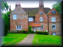 |
Greyhound Hill,
Hendon, London NW4 4JR
|
Phone: +44 (0)208 3593942 | |||||||||||||||||||||||||||||||||||||||||||||
| Hendon Adath Yisroel Synagogue | 11 Brent Street, Hendon, London NW4 2EU | |||||||||||||||||||||||||||||||||||||||||||||||
| Hendon Beis Hamedrash | 65 Watford Way, Hendon, London NW4 3AQ | |||||||||||||||||||||||||||||||||||||||||||||||
| Hendon Football
Club This Season
(2008/9) is the club's 100th, forty five of those
seasons have been spent in the top division of the
Isthmian (Ryman) League.Founded as Christ Church
Hampstead in 1908, a year later the club dropped
"Christ Church" in favour of becoming Hampstead Town
FC. "Town" was then dropped from the title in 1926.
Just six seasons later it was all change yet again
when officials proposed to rename the club
"Hendonian FC" although this was subsequently turned
down as there was already an Old Hendonians club in
the area. Other names that were submitted were:
Hendon Borough, Cricklewood and Hendon Central. In
the end all these were rejected in favour of
"Golders Green FC". It was only at the commencement
of season 1946/47 that the present name of Hendon
was adopted due to the ground lying within the
Borough of Hendon. The Borough has long since become
the London Borough of Barnet, but as another local
club already use that name, another change Even now
the club is often mistakenly referred to as "Hendon
Town", though it has never been called that. Before
the advent of the FA Umbro Trophy competition,
Hendon appeared five times in Amateur Cup Final at
Wembley Stadium, winning on three occasions. The
stadium, just five miles west of Claremont Road, was
filled to its 100,000 capacity when Hendon met
northern giants Bishop Auckland in the 1955 final.
Hendon also became the first club to play under
floodlights at the stadium when they were invited to
try out the new system. Denis Compton, born
just two miles from Claremont Road, played for the
club before leaving for Arsenal where he was to
become one of England's most famous sportsmen,
playing for his country at both football and
cricket. Leslie Compton was also with the club
before following his brother to Highbury.
|
Claremont Road, Brent Cross, London, NW2 1AE, E-mail : admin@hendonfc.net. HENDON FC CLICK |
Phone
: (020) 8908 3553 (10am-5pm) Fax to (020) 8905 5966. |
||||||||||||||||||||||||||||||||||||||||||||||
| Hendon Leisure
Centre
Fitness
Centre
Group Exercise Classes
Women Only Sessions
Sports Hall
Climbing Wall Indoor Facilities Toddlers' World Birthday parties |
Marble
Drive,
off
Claremont Road Brent Cross London NW2 1XQ HENDON LEISURE CENTRE CLICK |
Tel: 020 8455 0818 | ||||||||||||||||||||||||||||||||||||||||||||||
HENDON
KOSHER FOOD Click
here
for Kosher Eateries
|
||||||||||||||||||||||||||||||||||||||||||||||||
|
Hendon
Police College
Hendon Police College is the principal training
centre for the Metropolitan Police of London,
England. The Metropolitan Police Service (MPS)
is the Home Office police force responsible for
Greater London, with the exception of the square mile
of the City of London. Today more properly
called the Peel Centre, although frequently still
referred to by its old name (or just called Hendon
within the police), the centre is run by the Director
and Co-ordinator of Training for the Metropolitan
Police. Between 1,500 and 2,000 police recruits pass
through the centre each year to undertake its 17-week
residential basic training course. The centre runs
courses on many aspects of police work, from forensic
and crime scene analysis, to radio operations and
driving skills. Police officers can expect to return
to the centre at various times during their career.
Part of the centre is dedicated to the investigations
of serious crimes, including homicide. There are
extensive sports facilities. Homicide (Latin
homicidium, homo human being + caedere to cut, kill)
refers to the act of killing another human being.
Included in the centre is a mock court room, road
system and a police station, Brixley (formerly
Kingsgate) police station, used for training purposes
only. The Metropolitan Police Book of Remembrance is
displayed in the entrance of Simpson Hall at the
centre, and there is also a memorial garden. |
Aerodrome Road, Colindale, London NW4 | |||||||||||||||||||||||||||||||||||||||||||||||
| Hendon Reform
Synagogue HRS is a Reform
community, affiliated to the Movement for Reform
Judaism. We draw our strength and direction from the
Torah and from the rich Rabbinical interpretations
of the Talmud and our continuing history thus
keeping alive the living traditions of Judaism. A
warm and welcoming community, we encourage the equal
participation of men and women in our services where
both Hebrew and English are used.We promote learning
with regular classes for children on a Sunday
morning, the Rabbi's Shabbat morning class for Bar
and Bat Mitzvah children, regular Torah Breakfasts
plus interesting Adult Education programmes.HRS is
situated in the centre of Hendon although our
members come from a wide area of North West London
and surrounding districts including Hertfordshire
and Middlesex.We have many social activities that
take place during the week and events for all ages
and interests throught the year.
|
 |
Danescroft Avenue, |
Tel: (020) 8203 4168 Fax: (020) 8203 9385 |
|||||||||||||||||||||||||||||||||||||||||||||
| Hendon RFC Hendon RFC was
founded in 1932 and has since 1944 played rugby on
Copthall Playing Fields in Hendon. During this time
it has provided rugby for all standards of players
and continues to provide a welcome for those
individuals who enjoy a good game and the social
side of rugby. Our 1st XV play in Herts Middlesex
League 2 and our 2nd XV play in the Herts Middlesex
Merit Table. New players are always welcome
|
 |
Greenlands Lane, Copthall,
London, NW4 1RL HENDON RFC CLICK |
tel: 07957 294767 | |||||||||||||||||||||||||||||||||||||||||||||
| Hendon St. Mary
Church St Mary's has
been a centre of Christian worship in Hendon for
more than 1,000 years. It is now a thriving parish
in this busy North London suburb. We hope that you
find the information on this site a helpful
introduction to the life of the church, and we look
forward to welcoming you to St Mary's.
|
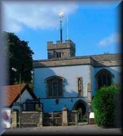 |
Church End, Hendon, London NW4 ST MARY CLICK |
tel: (020) 8203 2884 | |||||||||||||||||||||||||||||||||||||||||||||
| Hendon
Synagogue |
18
Raleigh Close, Wykeham Road, Hendon, London NW4 2TA http://www.hendonsynagogue.com |
|||||||||||||||||||||||||||||||||||||||||||||||
| Jewish Military
Museum This museum is
run by the Association of Jewish Ex-Servicemen and
Women and was established to commemorate the brave
contribution that British Jews have made to the
Armed Forces over two centuries. There are well over
a thousand artefacts and documents on display
consisting of memorabilia, books, personal artefacts
of soldiers, uniforms and medals. The Jewish Book of
Honour is housed in the museum that complies a role
of honour of more than 60,000 names who have served
since World War II.
|
 |
Harmony Way, Hendon,
London NW4 2BX
|
Phone: +44 (0)20 8202 2323 - Fax: +44 (0)20 8202 9900 | |||||||||||||||||||||||||||||||||||||||||||||
| London School of
Jewish Studies Join over 500
people every week at the centre of modern orthodox
Jewish learning in Britain. Book online for
our courses.
|
 |
Schaller House, 44a
Albert Road, London, NW4 2SJ
Email: info@lsjs.ac.uk
|
Phone: 020 8203 6427 Fax: 020 8203 6420 | |||||||||||||||||||||||||||||||||||||||||||||
| Royal Air Force
Museum Take off to the
Royal Air Force Museum London and soar through the
history of aviation. Gaze at a world-class
collection of over 100 aircraft. The Aeronauts
Interactive Centre offers hands-on entertainment and
education for all. The on site museum shop, is
packed with models and gift items. There is also a
café and licensed restaurant or picnic area to take
care of catering needs. Free entrance, free parking
and full disabled access.
|
 |
Phone: +44 (0)20 8205 2266 - Fax: +44 (0)20 8358 4981 | ||||||||||||||||||||||||||||||||||||||||||||||
| HORNSEY |
||||||||||||||||||||||||||||||||||||||||||||||||
| ICKENHAM |
||||||||||||||||||||||||||||||||||||||||||||||||
| St. Giles’ Church The pretty
church of St. Giles in Ickenham stands on the corner
of Swakeleys Road and the High Road, opposite the
village pond and old water pump. The church is
walking distance from Ickenham tube station
(Metropolitan and Piccadilly lines). The oldest part
of St. Giles’ Church dates back to 1335, with a
North Isle added in the 16th Century. As the small
hamlet of Ickenham grew, so did the church, with a
further extension added in 1959, and a second storey
above the choir vestry was built in1986.
|
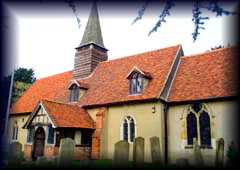 |
Swakeleys
Road,
Ickenham,
Middlesex UB10 Map E-mail St. Giles’ Church St. Giles’ Church Web site |
Phone:
+44
(0)1895
622971 |
|||||||||||||||||||||||||||||||||||||||||||||
| ISLEWORTH |
||||||||||||||||||||||||||||||||||||||||||||||||
| Osterley Park In 1761 the
founders of Child’s Bank commissioned Robert Adam to
transform a crumbling Tudor mansion into an elegant
neo-classical villa. This was their house in the
country, created for entertainment and to impress
friends and business associates. Today the
spectacular interiors contain one of Britain’s most
complete examples of Adam’s work. The magnificent
16th Century stables survive largely intact and are
still in use. The house is set in extensive park and
farmland, complete with pleasure grounds and garden
buildings.
|
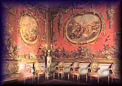 |
Jersey
Road, Isleworth, Middlesex TW7 4RB Map |
Phone: +44 (0)20 8568 7714 - Fax: +44(0)20 8568 7714 | |||||||||||||||||||||||||||||||||||||||||||||
| Redlees Studios This gallery
was set up by a group of artists who were looking
for a place that they could express themselves.
Since that time, the gallery has expanded and
developed a great name in the local art world.
Visitors can enjoy an eclectic range of exhibitions
throughout the year that focus on many different
disciplines and media form, including ceramics,
painting, sculpture, glasswork and jewellery.
|
Redlees
Park,
Worton
Road, Isleworth, London TW7 6DW Map E-mail Redlees Studios Redlees Studios Web site |
|||||||||||||||||||||||||||||||||||||||||||||||
| MILL HILL Mill Hill
Village is the ancient heart of the district, a
ribbon development along an ancient route called The
Ridgeway. It is thought that its name is derived
from a mill that once occupied a site on the
Ridgeway, on an area of open ground (now a park) now
known as the Mill Field, although whether a mill did
actually exist is still open to question. It is
bounded both to the north and south by Green Belt
land. Its proximity to London made it popular as a
country retreat from the 17th century onwards. There
are a number of large houses and quaint
cottages. There are a number of large
institutions including Mill Hill School, The
Missionary Insititute (which was present on the
Ridgeway until 2007), Holcombe House (part of the
Institute), The National Institute for Medical
Research, the motherhouse of The Daughters of
Charity and, until 2007, Saint Joseph’s College, a
large seminary. To the southwest is a small
suburban district called Poets' Corner, and to the
north an old estate, now a recreation ground, called
Moat Mount . Further north, on the Green Belt
between The Ridgeway and Totteridge Common, one of
the last remaining farms in the Greater London area
is situated, Burtonhole Farm. Mill Hill
Broadway is a suburban district that developed from
the 1900s onwards. The Broadway itself is an
important local retail area. There is a railway
station, Mill Hill Broadway, on the First Capital
Connect line, together with a bus station. The area
used to be served by another station,
University College London has an Observatory on the
A41 Watford Way, south west of The Broadway.
The eastern part of Mill Hill has recently undergone redevelopment, a new Waitrose having been built on the site of the old gas works. There is a tube station, opened in 1867, servicing a spur on the High Barnet Branch of the Northern Line. It is the least-visited station on the Northern Line - only one in eight northbound trains goes there.The small local retail area is at “Kelly’s Corner” (officially Holders Hill Circus but only on maps) east of the station. Here was Inglis Barracks home of the Middlesex Regiment between 1905 and 1962. The army still has a smaller presence here but this is now just a postal depot. The United Kingdom / Carl Zeiss / Bausch & Lomb Optical Works was established here in 1912 and demolished in about 1987. The Jehovah's Witnesses have had a centre here since 1958, and they redeveloped the optical works to become the International Bible Students' Association in 1988. To the south of Mill Hill East are Copthall and Holders Hill. |
||||||||||||||||||||||||||||||||||||||||||||||||
MILL HILL KOSHER FOOD
Click
here
for Kosher Eateries
|
||||||||||||||||||||||||||||||||||||||||||||||||
| RUISLIP & NORTHWOOD Ruislip-Northwood
was an urban district in Middlesex, England from
1904 to 1965. The urban district was created
in 1904, covering the parish of Ruislip, which had
previously been part of Uxbridge Rural District. The
parish and district also covered the Northwood area.
The district experienced a sharp rise in population,
from 6,217 in 1911 to 72,791 in 1961, caused by the
Metroland railway expansion and suburban house
building.It was abolished in 1965, and its area went
to form part of the London Borough of Hillingdon in
Greater London. The name survives in the
Ruislip-Northwood parliamentary constituency.
|
||||||||||||||||||||||||||||||||||||||||||||||||
| The Great Barn The Great Barn
is a lovely 13th Century Grade II listed building,
standing to the north of Ruislip High Street. The
Barn is part of the twenty acre Manor Farm, which
includes the Manor Farm House and the 16th Century
Little Barn. The farm was owned and let by Kings
College, Cambridge from the fifteen hundreds until
half way through the twentieth Century. It was a
working farm right up until the 1930s. Today the
Great Barn is a venue for local events.
|
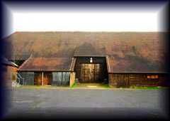 |
Bury
Street, Ruislip, Middlesex HA4 Map |
||||||||||||||||||||||||||||||||||||||||||||||
| Manor Farm House Manor Farm
House in Ruislip is a Grade II listed building,
attracting many visitors every year. The house dates
back to the 16th Century, and has origins in the
Doomsday Book. Recent excavations in 1997 uncovered
the remains of the site of the Abbey of Bec’s Priory
beneath the building. Opposite is a lovely 16th
Century barn, which luckily for the local people is
now home to Ruislip Library. There are other
outbuildings on this historic farm site dating as
far back as the 13th Century.
|
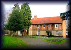 |
Ruislip,
Middlesex HA4 Map |
||||||||||||||||||||||||||||||||||||||||||||||
| St. Martin’s
Church St. Martin’s is
a beautiful Anglican church, situated on the corner
of the High Street and Eastcote Road and is easily
reached by Ruislip tube station on the Metropolitan
Line. This historic building is mentioned in the
Doomsday Book and the oldest item of furniture in
the church dates from the 14th Century. There has
been a church on this site for nearly a thousand
years. St. Martin’s is attractive both inside and
out with eye catching wall paintings, pews and
stained glass windows.
|
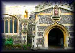 |
High
Street, Ruislip, Middlesex HA4 7AU Map St. Martin’s Church Web site |
||||||||||||||||||||||||||||||||||||||||||||||
| SOUTHALL |
||||||||||||||||||||||||||||||||||||||||||||||||
| SOUTHGATE was a local
government district of Middlesex from 1881 to 1965.
It was part of the London postal district and
Metropolitan Police District.The area was
historically part of the parish of Edmonton, which
adopted the Public Health Act 1848 and formed a
local board of health to govern the area in 1850. In
1879 the ratepayers of Southgate petitioned for
their area to be separated from Edmonton, and in
1881 Southgate Local Board was established, with
nine members.It was created an urban district in
1894, under the Local Government Act 1894. The urban
district council was increased in size to 12
councillors in 1900. In 1933 Southgate was granted a
charter of incorporation and became a municipal
borough. The corporation of the borough consisted of
a mayor, seven aldermen and twenty-one councillors.
In 1965, the municipal borough was abolished and its
former area transferred to Greater London under the
London Government Act 1963. Its former area was
combined with that of the Municipal Borough of
Enfield and the Municipal Borough of Edmonton to
form the present-day London Borough of Enfield. The
borough included Southgate itself as well as
neighbouring areas, including Palmers Green. The
borough was administered from Southgate Town Hall,
which is situated on Green Lanes in Palmers Green,
close to the junction with Broomfield Lane.
|
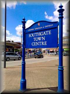 |
|
||||||||||||||||||||||||||||||||||||||||||||||
| |
||||||||||||||||||||||||||||||||||||||||||||||||
| The Chicken Shed Chickenshed is
a theatre company. We work using an inclusive
creative process which means everyone is
welcome, and everyone is valued. Not many places are
for everyone and anyone - so a lot of people who
find themselves unwelcome elsewhere in the world,
come to us. Chickenshed runs Children's and Youth
Theatre workshops for 600 people, education courses
for over 100 students, community outreach projects
and a network of satellite 'Sheds' across the
country (and one in Russia) so even more can
benefit. Every extraordinary piece of theatre
created at Chickenshed shouts out the same thing:
anyone can thrive in an environment where everyone
is welcome. Using our unique
creative process, our theatre company has
created and produced more than 1,000 performances of
extraordinary theatre since Chickenshed started in
1974.
|
 |
Chase
Side Southgate London N14 4PE CHICKEN SHED CLICK |
Box Office: 020 8292 9222 | |||||||||||||||||||||||||||||||||||||||||||||
| Christ Church,
This church was
built with a broached spire in 1861-3 and designed
by Sir George G. Scott. It replaced the chapel built
by Sir John Weld of Arnolds in 1615. Probably the
main feature of this church is the fine collection
of stained glass by Morris & Co. and there is
work by William Morris, Philip Webb, Ford Madox
Brown, and Burne-Jones. In addition the high altar
has a reredos by Salviati.
|
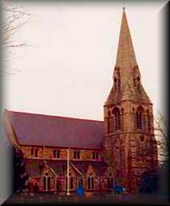 |
Waterfall Road and The Green, Southgate, London N14. | ||||||||||||||||||||||||||||||||||||||||||||||
|
Cockfosters
& N Southgate Synagogue
is a
long-established community, founded in 1948, and
srving the Jewish population of Southgate,
Cockfosters and Hadley Wood – with over 1100
members and covering an area almost 5 miles
across.Our synagogue in Old Farm Avenue,
Southgate, is backed up by Minyanim held regularly
in Cockfosters and now also in Hadley Wood. Unlike
most communities in London we have been successful
in maintaining the membership numbers and this is
very much due to the enthusiasm and hard work of
all the numerous groups and committees that look
after the varied needs and interests of the
community.
|
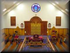 |
Old
Farm Avenue Southgate London N14 5QR map COCKFOSTERS & N.SOUTHGATE SYNAGOGUE CLICK |
Phone:
020
8886
8225 Fax: 020 8886 8234 |
|||||||||||||||||||||||||||||||||||||||||||||
| Southgate Cricket
Club Middlesex plays
here and there's an annual cricket festival in
August.New to North London? Fancy playing cricket
for one of the oldest and most famous cricket clubs
in Middlesex? Southgate Cricket Club has
opportunities for regular club players and match
officials for the 2009 season. We will be commencing
indoor net sessions in January on Wednesday nights
and would welcome any prospective new members. We
run 4 teams on Saturdays and 1 team on a Sunday, we
also provide coaching sessions for Junior players
and run teams from U10 upwards. If you'd like to
know more about the club please get in touch.
|
 |
The
Walker Cricket Ground, Waterfall Road, N14 SOUTHGATE CC CLICK Nearest Tube Station: Southgate |
Tel: +44 (0)20 8886 8381 | |||||||||||||||||||||||||||||||||||||||||||||
SOUTHGATE
KOSHER
FOOD
Click
here
for Kosher Eateries
|
||||||||||||||||||||||||||||||||||||||||||||||||
| St. Andrews Church This
church built in a red brick gothic style was
designed by A.R. Barker, with a sanctuary and north
chapel extension by Barker & Kirk in 1916. There
is an ambulatory passage behind the high altar.
|
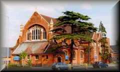 |
Chase Side, Southgate, London N14. | ||||||||||||||||||||||||||||||||||||||||||||||
| St. Thomas Church. This church was
built in 1938-41 and was designed by Romilly Craze.
It has a copper spire. The stained glass window in
the Lady Chapel is by Alfred Fisher.
|
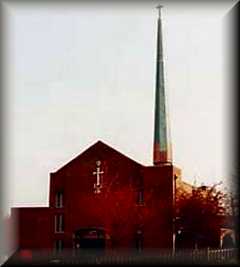 |
Prince George Avenue, Oakwood, London N14 | ||||||||||||||||||||||||||||||||||||||||||||||
| Southgate
Station |
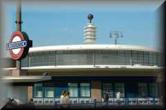 |
|||||||||||||||||||||||||||||||||||||||||||||||
|
The area was recorded in the Domesday Book as
Stanmere, the name deriving from the Old English stan,
'stony' and mere, 'a pool'. There are outcrops of
gravel on the clay soil here and the mere may have
been one of the ponds which still exist.By 1574 the
area had become known as Stanmore the Great to
distinguish it from Little Stanmore. Stanmore Village railway station was open for train services between 1890 and 1952. Stanmore tube station opened in 1932. Stanmore had an outstation from the Bletchley Park codebreaking establishment, where some of the Bombes used to decode German Enigma messages in World War Two were housed. Stanmore is also home to RAF Bentley Priory from where the Battle of Britain was controlled, also formerly to RAF Stanmore Park, HQ of Balloon Command. The latter closed in 1997 and is now a housing estate.The suburb is characterised by numerous small restaurants and cafés, several public houses, and a handful of boutique-style clothing stores. The centre of Stanmore is dominated by the presence of a large Sainsbury's supermarket. Stanmore's extensive residential areas are leafy and predominantly affluent, with many residents commuting daily to jobs in central London and the City.Stanmore is home to Stanmore College (a government further education establishment) and a local library. The suburb also hosts the Royal National Orthopaedic Hospital - known as RNOH - which is famed for its spinal unit. Stanmore has affluent Indian, Jewish and Catholic communities, including its local synagogue on London Road and a mosque as well as new Hindu Temple on Wood Lane |
||||||||||||||||||||||||||||||||||||||||||||||||
STANMORE KOSHER FOOD Click
here
for Kosher Eateries
|
||||||||||||||||||||||||||||||||||||||||||||||||
| TOTTENHAM There has been
a settlement at Tottenham for over a thousand years.
It grew up along the old Roman Road, Ermine Street
(some of which is part of the present A10 road), and
between High Cross and Tottenham Hale, the present
Monument Way.Tottenham is believed to have been
named after Tota, a farmer, whose hamlet was
mentioned in the Domesday Book; hence Tota's hamlet
became Tottenham. Toteham as it was then known was
mentioned in the Domesday Book.[1] When it was
compiled in 1086, about 70 families lived within the
area of the manor, mostly labourers working for the
Lord of the Manor.In 1894, Tottenham was made an
urban district and on 27 September 1934 it became a
municipal borough. As from 1 April 1965, the
municipal borough formed part of the London Borough
of Haringey. The River Lee (or Lea) was the eastern
boundary of the Municipal Boroughs of Tottenham and
Walthamstow. It is the ancient boundary between
Middlesex and Essex and also formed the western
boundary of the Viking controlled Danelaw. Today it
is the boundary between the London Boroughs of
Haringey and Waltham Forest. A major tributary of
the Lee, the River Moselle, also crosses the borough
from west to east, and often caused serious flooding
until it was mostly covered in the 19th century.
|
||||||||||||||||||||||||||||||||||||||||||||||||
| Euroart
Studios Euroart Studios
combines a gallery with a place of work for artists.
Essentially operating as a collective, visitors are
given the chance to see inside the artists’ studios
and watch the creative minds at work, as well as
browse through the first class gallery of completed
work. The centre offers a new and exciting approach
to art in the area and is committed to involving the
community in the art world.
|
784/788
High
Road,
Tottenham, London N17 0DA Map E-mail Euroart Studios Euroart Studios Web site |
Phone: +44 (0)7802 502136 | ||||||||||||||||||||||||||||||||||||||||||||||
| Markfield Beam
Engine Museum Housed in
a grade II listed building, the old engine house,
this museum is on a six and half acre site. The
principal exhibit in the museum is the Wood Brothers
Beam Steam Pumping Engine, manufactured in 1886, and
the principal water pump for the Tottenham area for
decades. Visitors are invited to view the
magnificent machine, the interesting structure in
which it is housed, and a series of related
explanatory exhibits.
|
Markfield
Road,
Tottenham,
London N15 4RB Map E-mail Markfield Beam Engine Museum Markfield Beam Engine Museum Web site |
Phone: +44 (0)1707 873628 | ||||||||||||||||||||||||||||||||||||||||||||||
 Tottenham
Hotspur
Football Club Tottenham
Hotspur
Football ClubTottenham
Hotspur Football Club has a long and illustrious
history in the top flight of the domestic game.
Throughout the years the club has been home to some
of the great players of the beautiful game including
Blanchflower, Hoddle, Lineker, Klinsmann, Gascoigne
and Ginola to name but a few. White Hart lane
Stadium is the home of the team, who play fixtures
on a regular basis here between August and May every
year. With a reputation for playing entertaining
football, this is a great place to see a game.
|
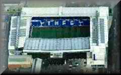 |
Tottenham
Hotspur
-
White Hart Lane Bill Nicholson Way, 748 High Road, London, Middlesex. N17 0AP Map E-mail Tottenham Hotspur FC Tottenham Hotspur FC Web site Fixture List 2008/9 |
Main
Telephone No: 0844 499 5000 Main Fax No: 020 8365 5005 Ticket Office: 0844 844 0102 |
|||||||||||||||||||||||||||||||||||||||||||||
TOTTENHAM KOSHER FOOD Click
here
for Kosher Eateries
|
||||||||||||||||||||||||||||||||||||||||||||||||
| TWICKENHAM |
||||||||||||||||||||||||||||||||||||||||||||||||
| Marble Hill House A magnificent
Thames-side Palladian villa, Marble Hill House was
built in the 1720s for Henrietta Howard, Countess of
Suffolk and mistress of King George II. See the
extravagant gilded rooms in which she entertained
famous poets and wits of the age including Pope, Gay
and Swift. Explore the 66 acres of beautiful
riverside grounds or enjoy a game of tennis or mini
golf.
|
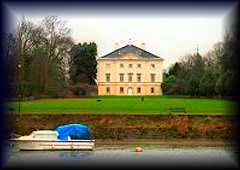 |
Richmond
Road,
Twickenham TW1 2NL Map Marble Hill House Web site |
Phone: +44 (0)208 892 5115 - Fax: +44 (0)20 8607 9976 | |||||||||||||||||||||||||||||||||||||||||||||
| Museum of Rugby Whether you are
a rugby supporter or not, you will love Britain’s
top sporting museum - The Museum of Rugby and
Twickenham Stadium Tours offer a behind the scene
look at the home of England rugby and the history of
the game. Prepare to be inspired - spend a day in
the life of rugby.
|
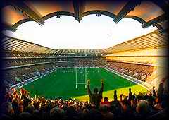 |
Twickenham
Stadium, Rugby Road, Twickenham TW1 1DZ Map E-mail Museum of Rugby Museum of Rugby Web site |
Phone: +44 (0)20 8892 8877 - Fax: +44 (0)20 88922817 | |||||||||||||||||||||||||||||||||||||||||||||
| Orleans House
Gallery This
gallery is responsible for looking after the
prestigious Richmond Borough Art Collection, of
which there are nearly three thousand separate
artworks within. The fantastic gallery allows
visitors to experience a wide variety of different
styles of work that have been collected from a broad
school of painters and sculptors based in Europe and
across the globe.
|
Riverside,
Twickenham,
London
TW1 3D Map E-mail Orleans House Gallery |
Phone: +44 (0)20 8831 6000 - Fax: +44 (0)20 8744 0501 | ||||||||||||||||||||||||||||||||||||||||||||||
|
Strawberry Hill
House
Strawberry Hill House is one of the finest
examples of Georgian Gothic Revival architecture in
the country. The coachman of the Earl of Bradford were
responsible for the earliest building which was begun
in 1698. Horace Walpole, son of the first Prime
Minister, transformed the building into a ‘ little
Gothic Castle’. Between 1747 and 1792, Walpole doubled
the building in size and created the majority of what
visitors can see today, a spectacular collection of
interior and exterior beauty. |
Strawberry
Hill
Close,
Twickenham, London TW1 4PX Map E-mail Strawberry Hill House Strawberry Hill House Web site |
Phone: +44 (0)870 626 0402 | ||||||||||||||||||||||||||||||||||||||||||||||
| UXBRIDGE |
||||||||||||||||||||||||||||||||||||||||||||||||
| Uxbridge
Treasure Hunt No prior knowledge of Uxbridge is
required as all clues are solved by
observation. Both young and old will be
fascinated whilst getting out for a couple of hours
seeing the sites and solving the clues. Children
will enjoy beating adults to solve the clues!
We even supply a map just in case you get
lost. The answers are at the back of the book
so you can check any unsolved ones before you
leave.The hunt starts at the Central Library and
Information Centre , High Street, Uxbridge, UB8 1HD.
From Uxbridge or just visiting, you will be
surprised at how much you walk past without even
noticing. We so often walk around blinkered without
appreciating the great features which make our towns
and cities fabulous. By following our hunt these
things will be highlighted rather than hidden away.
Our Uxbridge treasure hunt packs contain all the
necessary elements for you need including maps,
clues, answer sheet, and tips on how to get things
going.
|
 |
|||||||||||||||||||||||||||||||||||||||||||||||
| Colne Valley Park
Visitor Centre The Colne
Valley provides the first significant area of
countryside west of London – a mosaic of farmland,
woodland and water, with fifty miles of river and
canal and over forty lakes. It is a living, working
environment providing employment and homes for many
people. It is also a special place, regionally
important for recreation and internationally
important for wildlife. Large areas are open to the
public or accessible through a network of paths.
|
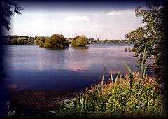 |
Denham Country Park,
Denham Court Drive, Denham, Uxbridge UB9 5PG
|
Phone: +44 (0)1895 833375 - Fax: +44 (0)1895 833552 | |||||||||||||||||||||||||||||||||||||||||||||
| Contemporaryartwest Like
many
of the great contemporary art galleries, this
project started with the vision of a group of young
artists who were desperate to find somewhere to show
their own work. What followed was the establishment
of one of the best respected galleries in this area
of London, a place that has built a reputation for
developing and nurturing young talent and taking it
on to the next level.
|
The
Green, West Drayton, Uxbridge, London UB8 3LD Map |
Phone: +44 (0)7977 133093 - Fax: +44 (0)79329 61389 | ||||||||||||||||||||||||||||||||||||||||||||||
| Dominion Arts
Education Centre The Dominion
Arts Education Centre is not only a place where you
can see great art on display, it is also a place
where you can learn more about the history of art,
and learn more about the steps that can be taken to
get involved in artistic projects. This excellent
centre has been open for many years and has quickly
become a well respected part of the cultural scene
locally.
|
112
The Green, Southall, Uxbridge, Greater London UB2 4BQ Map E-mail Dominion Arts Education Centre |
Phone: +44 (0)20 8843 1227 - Fax: +44 (0)20 8813 8791 | ||||||||||||||||||||||||||||||||||||||||||||||
| Ethnic Minority
Studies Centre Britain is a
country that is one of the most ethnically diverse
anywhere on earth. There are people from across the
globe who have made their homes on these shores.
This fascinating centre is concerned with the study
of the people who come and start new lives in
Britain, but remain minority groups. How do they
cope? The exhibitions and displays help to tell the
story of many ethnic groups in Britain and across
the world.
|
Royal
Holloway, University of London, Uxbridge, London TW20
0EX Map Ethnic Minority Studies Centre Web site |
Phone: +44 (0)1784 443816 - Fax: +44 (0)1784 430680 | ||||||||||||||||||||||||||||||||||||||||||||||
| WEMBLEY Wembley is an
area located in North-West London, England which
forms the northern part of the London Borough of
Brent. It is located 8 miles (13 km) north-west of
Charing Cross. Forming the north-western part of
Brent. Wembley has a large Indian population. When
it was merged with the Borough of Willesden in 1965
as part of the re-organisation of London Local
Government, Willesden was formerly an affluent
borough with a large Jewish Population. Since the
1970s, it has undergone population movement and the
influx of various immigrant groups. Wembley
has two new areas of its own town, Wembley Central
and Wembley City, Wembley Central is the Central
area of Wembley, Wembley City is the Wembley Park
part, Wembley City contains Wembley Stadium, Wembley
Arena and Wembley Market.Wembley was
the centre of the municipal organisation of the
area, with the Wembley Town Hall in Forty Lane, now
serving as Brent Town Hall. The former Middlesex
County Council, abolished in 1965 when the Greater
London Council was created, had its Fire Brigade
headquarters in Harrow Road, Wembley. The fire
station there still operates as part of the London
Fire Brigade. The large Wembley Police Station is
next door.
|
||||||||||||||||||||||||||||||||||||||||||||||||
| Artangel Trust Artangel is a
project that has tried to bring together artists who
are based in London and get their works on display
across the country. The organisation has been very
successful in getting large scale commissions in the
streets and large public buildings. It also has its
own gallery, theatre and cinema on site where a
great deal takes place.
|
Engineers
Way,
Wembley,
London HA9 0PB Map E-mail Artangel Trust Artangel Trust Web site |
Phone: +44 (0)20 7713 1402 | ||||||||||||||||||||||||||||||||||||||||||||||
| Barham Park Located in the
northern extremities of Wembley, part of the London
Borough of Brent, Barham Park is one of the
principle areas of rest and relaxation in the
region. The park has been well landscaped with
trees, flower beds and water features to create as
greener feel as is possible in the busy north London
streets. There is a large children’s playground
within, which is popular all year round.
|
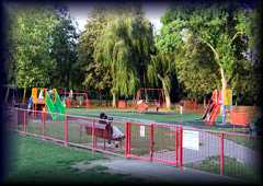 |
Harrow
Road, Wembley, London HA0 2HB Map |
||||||||||||||||||||||||||||||||||||||||||||||
| Brent Central
Library This library is
housed at the heart of the London Borough of Brent
and serves as one of the cultural and social centres
for this busy London area. The centre offers a large
range of books, audio and visual materials available
for loan and for reference. The library is host to a
number of cultural events throughout the year
including art exhibitions and historical archives on
display.
|
Chesterfield
House,
Wembley,
London HA9 7RW Map |
Phone: +44 (0)20 8937 3144 | ||||||||||||||||||||||||||||||||||||||||||||||
| St. Stephen's
Church St. Stephen’s
is an impressive turn of the century Victorian style
Catholic church located at the heart of the
Wembley Park area, close to the stadium and
conference centre. The church is home to an
extremely large and diverse Catholic congregation
who are reflective of the mixed roots of the local
area. They meet regularly on the site in prayer.
|
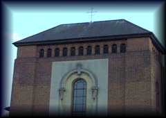 |
St.
Stephen's Gardens, Wembley, London HA9 9HA Map |
||||||||||||||||||||||||||||||||||||||||||||||
| Wembley Arena Wembley Arena
is located opposite Wembley Stadium and is a
world-famous venue for live entertainment. It’s
London’s busiest music venue in terms of ticket
sales, with a capacity of 12,300. It is widely
regarded as the best London venue for sound quality
and has staged many big name acts, including David
Bowie, Kylie Minogue, Madonna, Britney Spears, The
Beatles, ABBA, Queen and the Spice Girls. A £35m
refurbishment of the venue was completed in 2006.
|
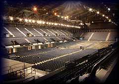 |
Elvin
House, Wembley, Middlesex HA9 0DW Map Wembley Arena Web site |
Phone: +44 (0)208 902 8833 | |||||||||||||||||||||||||||||||||||||||||||||
Wembley Kosher Food (
Click
here
for Kosher Eateries
|
||||||||||||||||||||||||||||||||||||||||||||||||
| Wembley Stadium Wembley Stadium
stands on the site of the famous old sporting venue
of the same name. The twin towers have been replaced
by a huge steel arch that can be seen from almost
anywhere of elevation in the capital. Wembley
Stadium is the home of English Football and is the
place to see England matches, the FA Cup Final and
numerous other sporting and musical events
throughout the year.
|
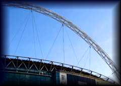 |
Empire
Way,
Wembley,
London HA9 0WS Map Wembley Stadium Web site |
Phone:
+44
(0)208
795 9000 |
|||||||||||||||||||||||||||||||||||||||||||||
| WILLESDEN The name
derives from the Anglo-Saxon Willesdune, meaning The
Hill of the Spring and a settlement bearing
this name dates back to 939 AD. The Doomsday Book of
1086 records it as Wellesdone[ . The town's motto is
Laborare est orare.
|
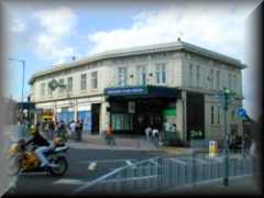 |
|||||||||||||||||||||||||||||||||||||||||||||||
|
Brahma Kumaris
World Spiritual University (UK)
The National
Coordinating Office for the UK wing of this
international spiritual organisation lies just north
of Willesden Fire Station in a large, brown
building. The Hindu-based teachings on offer have
their roots in visions received by founding father
Baba Brahma, a wealthy philanthropist in what is now
Pakistan in the 1930s. The venerable Baba passed on
in 1969 at the grand old age of 93 but the
university continues to scatter his seeds of wisdom
through branches from Estonia to Equatorial Guinea.
Raja Yoga Meditation techniques are promoted as a
path to spiritual enlightenment.
|
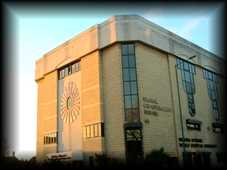 |
Global
Co-Operation
House,
65-69 Pound Lane, Willesden, London NW10 2HH Map E-mail Brahma Kumaris Brahma Kumaris Web site |
Phone: +44 (0)20 8727 3350 - Mobile: +44 (0)20 8727 3351 | |||||||||||||||||||||||||||||||||||||||||||||
| Brent Museum Brent Museum is
housed in the centre of the London Borough and is
dedicated to the long and interesting history of the
community. There are a great many fine pieces on
display, some of which have been discovered in
archaeological digs, and other pieces that have been
collected from houses and families that have been
situated in the area. There are antiques, paintings,
documents and maps for visitors to enjoy.
|
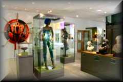 |
95
High Road, Willesden Green, London NW10 2SF Map E-mail Brent Museum BRENT MUSEUM CLICK |
Phone: +44 (0)20 8937 3600 | |||||||||||||||||||||||||||||||||||||||||||||
| Brondesbury Park
Open Space While this tiny
park and playground might seem like nothing to go
out of your way for, the quiet leafy environs make
park makes it a nice, safe spot for toddlers and a
tranquil and relaxing environment for mummy and
daddy to take a break. It’s also conveniently just a
few minutes brisk walk from Willesden Green
underground station and, in the other direction,
Willesden Green Library Centre. Adoining the open
space is the Brondesbury Park Synagogue.
|
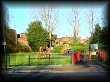 |
Brondesbury
Park,
London NW2 5JN Map |
||||||||||||||||||||||||||||||||||||||||||||||
| Church Road Park This beautiful
park is an ancient place of rest and recreation for
the people of the north west London borough. It is
located close to the old parish church of St. Mary's
and has always been closely linked with community
activities and events. The park is used by locals
and visitors as a place to play, walk, run and
simply sit and watch the world go by.
|
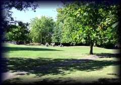 |
Church
Road,
Willesden,
London NW10 Map |
||||||||||||||||||||||||||||||||||||||||||||||
| Church of Deeper
Spiritual Faith The Church of
Deeper Spiritual Faith is an Apostolic Church on the
border between Harlesden and Willesden in north west
London. The church is located in a relatively simple
and modern building on the main road. The facility
is home to a committed and welcoming Christian
congregation who meet on a regular basis.
|
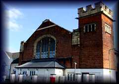 |
Church
Road,
Willesden,
London NW10 Map |
||||||||||||||||||||||||||||||||||||||||||||||
| Church of God The
Church
of God in Willesden is a Christian community based
in a converted house that now serves as a place of
worship. Located at the very heart of the community
on the High Road, the church is home to an eclectic
Christian congregation that reflects the diverse
make-up of the area it serves.
|
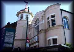 |
High
Road, Willesden, London NW10 2SD Map |
||||||||||||||||||||||||||||||||||||||||||||||
| Cricklewood
Baptist Church Cricklewood
Baptist
Church
is located close to Cricklewood and Willesden in
north west London. The church is a fine example of a
city church and is well used by the significant
Baptist community of the area. The church is home to
a friendly congregation who like to take a leading
role in community affairs and charitable works.
|
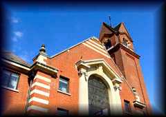 |
2
Sneyd Road, Cricklewood, Willesden, London NW2 6AN Map |
||||||||||||||||||||||||||||||||||||||||||||||
| Elim Pentecostal
Church The Elim
Pentecostal Church is better known as the 'Church on
the High Road' and is located on the main shopping
street at the heart of the busy north western suburb
of Willesden in London. The church is thought to
have been built in the mid 20th Century and has
close links with the people of the community. It is
home to a committed Christian congregation who meet
there regularly.
|
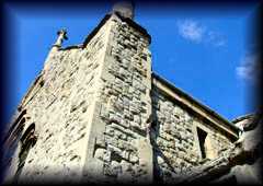 |
High
Road,
Willesden,
London NW10 Map |
||||||||||||||||||||||||||||||||||||||||||||||
| Gallery at
Willesden Green This artist-led
gallery was founded in 1984 and since then has grown
from strength to strength, serving the cultural
needs of the people of Brent and the many visitors
to the area. The gallery hosts a variety of
contemporary art exhibitions throughout the year and
attempts to encourage participation from members of
the public in the art world. There is a range of
workshops and lectures at the gallery as well as a
regular programme of exhibitions.
|
 |
95
High Road, Willesden Green, London NW10 2SF Map E-mail Gallery at Willesden Green Gallery at Willesden Green CLICK |
Phone: +44 (0)208 459 1421 | |||||||||||||||||||||||||||||||||||||||||||||
| Mosque of Brent This Mosque of
Brent is a large Islamic centre and place of worship
on the edge of Cricklewood and Willesden in north
west London. The beautiful building has some of the
finest minarets in this area of London and is an
extremely well used facility. It is home to a large
community of Muslims that come from all over the
community to worship here.
|
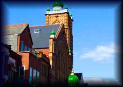 |
33a
Howard Road, Willesden, London NW2 6DS Map |
||||||||||||||||||||||||||||||||||||||||||||||
| Royal Majestic
Suite Housed in an
attractive brown-brick building with a distinctive
portico, these banqueting and function rooms are
particularly popular with the Jewish community and
recommended for Barmitzvahs. The fare ranges from
burger and fries to Scottish salmon with lemon and
dill. Chinese or American-style buffets are also an
option. Naturally, everything is strictly Kosher,
with the preparation supervised by the Jewish
authority the London Beth Din. The function
coordinators proudly promise the “celebration of
your dreams”.
|
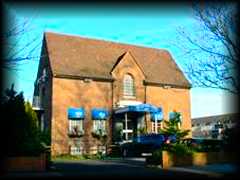 |
196
Willesden Lane, Willesden Green, London NW6 7PR Map E-mail Royal Majestic Suite Royal Majestic Suite Web site |
Phone: 020 8459 3276/0567 - Mobile: +44 (0)20 8451 0920 | |||||||||||||||||||||||||||||||||||||||||||||
| Seventh Day
Adventist Church The Seventh Day
Adventist Church of Willesden is housed in a modern
building on the High Road in the very heart of the
bust London suburb. The church draws a large
congregation from across the socio-economic spectrum
and enjoys an eclectic multi-cultural influence. It
is proud to be a part of the community and the
members regularly involve themselves in community
events.
|
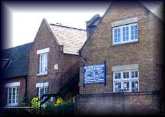 |
High
Road, Willesden, London NW10 Map |
||||||||||||||||||||||||||||||||||||||||||||||
| Shree Swaminarayan
Temple Members of the
five-million strong Swaminarayan Sampradaya Hindu
sect have worshipped here since 1975. Back then, the
Willesden Temple, as it was known, was just a
converted church, and it wasn’t until 1988 that the
current eye-catching edifice was unveiled. The three
storey complex melds British and Indian design and
incorporates prayer and community rooms, audiovisual
resources and even a picture framing service. Yoga,
Gujarati and Tabla classes are also available. Catch
the temple in autumn when it lights up the night
during Diwali.
|
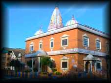 |
220/222
Willesden
Lane,
Willesden Green, London NW2 5RG Map E-mail Shree Swaminarayan Temple Shree Swaminarayan Temple Web site |
Phone: +44 (0)20 8459 4506 | |||||||||||||||||||||||||||||||||||||||||||||
| St Mary Magdalen's
Catholic Church With its
imposing tower, adorned with a large white crucifix,
St Mary Magdalen's is the main Catholic church in
Willesden. The church had its humble beginnings as a
Mass centre in nearby St Paul's Avenue until
Cardinal Bourne, the Archbishop of Westminster,
conferred parish status on Willesden in 1903. These
days, Mary Mags, as it’s affectionately known, pulls
in a healthy congregation from around Brent. Mass is
held daily at 9:30am, with an extra session at
6:30pm on Mondays and Fridays. On Sundays there are
additional mass times of 10:30am and 12 noon.
|
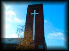 |
Parish
of St Mary Magdalen, Clergy House, Peter Avenue,
Willesden, London NW10 2DD Map E-mail St Mary Magdalen's St Mary Magdalen's Web site |
Phone: +44 (0)20 8451 4677 - Mobile: +44 (0)20 8451 0288 | |||||||||||||||||||||||||||||||||||||||||||||
| St. Andrew the
Apostle Church St. Andrew's is
the main parish church of Willesden and Willesden
Green, a vibrant and busy area of north west London.
The building is noted for having some fine stained
glass within and also has the Good Shepherd Chapel.
The church is well used by a broad section of the
community and is one of the focal points of social
life in the area.
|
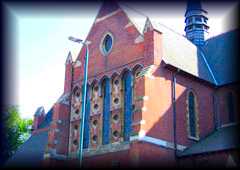 |
High
Road, Willesden, London NW10 Map |
||||||||||||||||||||||||||||||||||||||||||||||
| St. Gabriel's
Church St. Gabriel's
Church is a fine structure situated on the
Cricklewood side of Willesden, not far from
Willesden Green Underground Station. The church is
built of grey stone and is particularly noted for
its interesting tower with a small roof. The church
is home to a large and friendly Christian community
which is always looking to expand with new members.
|
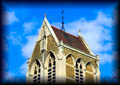 |
St.
Gabriel's Road, Willesden, London NW2 Map |
||||||||||||||||||||||||||||||||||||||||||||||
| St. Mary's Church St. Mary's is a
beautiful old historic church at the end of Church
Road where it become High Road in the older part of
Willesden. The church is thought to be pre-Norman
and date from the late 930s AD. It is still a
functional place of worship and would look more in
keeping with being in a countryside village than an
inner city suburb.
|
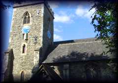 |
High
Road, Willesden, London NW10 Map |
||||||||||||||||||||||||||||||||||||||||||||||
| True Buddha Temple The True Buddha
School was established in the 1980s by Taiwan-born
"living Buddha" Lu Sheng-yen and now has chapters
around the globe. Despite being essentially a
Buddhist sect, the TBS is strongly influenced by
Taoist strands of thought. The temple building was
originally home to a Welsh boys school but was
converted in the mid-90s, when Chinese-style
renovations such as the colourful turrets on the
roof, and the large incense burner and marble dragon
out front were added.
|
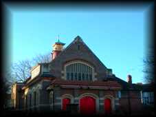 |
265
Willesden Lane, Willesden Green, London NW2 5JG Map True Buddha Temple Web site |
Phone: +44 (0)20
8451 9118 - Mobile: +44 (0)20 8451
9677
|
|||||||||||||||||||||||||||||||||||||||||||||
| Universal Church
of the Kingdom of God Help Centre Nominally a
Christian drop-in centre, this branch of the
Brazilian-based UCKG is located on the site of the
former Willesden Synagogue. The church was founded
in 1979 by two Pentecostal preachers who split off
from the more traditional mainstream doctrine. In
Brazil the UCKG is not just the fastest-growing
faith, it has also become a major political force.
In the UK there are 20-odd branches. Services are
7am, 10am, 3pm and 7:30pm with other events and
activities taking place on a regular basis.
|
 |
17
Heathfield Park, Willesden Green, London NW2 5JE Map UCKG Web site |
Phone: +44 (0)20 8459 8181 | |||||||||||||||||||||||||||||||||||||||||||||
| Willeseden Green
Baptist Church Willesden Green
Baptist Church is a large 'city' style Baptist place
of worship at the very heart of the Willesden
community. Located on the High Road, the church has
for generations provided a place of quiet prayer and
contemplation for Christians from across the suburb
and nearby areas of London.
|
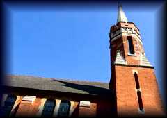 |
94
High Road, Willesden, London NW10 2PR Map |
||||||||||||||||||||||||||||||||||||||||||||||
| Willesden Green
Library Centre Willesden Green
Library Centre is a multi-purpose local authority
owned facility at the centre of Willesden in London.
The centre provides all of the usual library lending
and research facilities as well as being an
information centre, a place of exhibitions,
seminars, courses and public addresses. The library
has state of the art computer facilities available
to the use of the public.
|
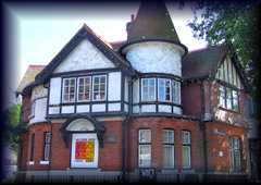 |
95
High Road, Willesden Green, London NW10 2SF Map |
Phone: +44 (0)20 8937 3400 | |||||||||||||||||||||||||||||||||||||||||||||
| Willesden Sports
Centre and King Edward VII Park This leisure
centre has been serving the community since the
1960s. In 2004, it closed for a major facelift,
reopening to the public in autumn 2006. The new
centre boasts a 25-meter six-lane pool, ball courts,
a gym, dance studios, a dojo and a 60-meter indoor
running tube. The improvements extend to the
exterior where you can jog by night on a floodlit
400-meter track. Changing rooms were also added for
the adjoining King Edward VII park, where Sunday
football is played.
|
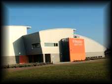 |
Donnington
Road,
Willesden,
London NW10 3QX Map E-mail Willesden Sports Centre Willesden Sports Centre Web site |
Phone: +44 (0)20 8955 1120 - Mobile: +44 (0)20 8955 1124 | |||||||||||||||||||||||||||||||||||||||||||||
| Wood Green |
||||||||||||||||||||||||||||||||||||||||||||||||
| Alexandra Palace Set in 196
acres of gorgeous parkland overlooking London, “Ally
Pally” as it is affectionately known has a long and
fascinating history. Built in 1873 to provide the
Victorians with a great environment and recreation
centre, it was destroyed by a fire just sixteen days
after its opening. 2 years later, a new Palace
opened. The BBC made the first public television
transmissions from the eastern wing in 1936.
Nowadays the Palace is an events and exhibition
centre, and also houses an ice rink.
|
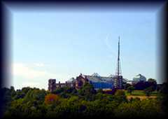 |
Alexandra
Palace
Way,
Wood Green, London N22 7AY Map E-mail Alexandra Palace Alexandra Palace Web site |
Phone: +44 (0)20 8365 2121 - Fax: +44 (0)20 8883 3999 | |||||||||||||||||||||||||||||||||||||||||||||
| Alexandra Palace
Ice Skating Rink Ice Skating
Club – Every Saturday - Ice Skating Tuition –
private lessons or classes for all ages -
Toddlers on Ice – every Tuesday during term
time - Birthday Parties - Includes meal &
tuition - Children's Skating Courses - After
school course for 5-15 year olds
hildren's Crash Courses - Throughout most school
holidays - Ballet Classes - Ice Dance
Club - Disabled Skating -Adult Skating
Courses .With a total capacity of 1,250 including a
seating area for 741 plus one Cafe and a bar, the
Ice Rink provides the perfect leisure day out.
|
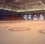 |
Alexandra
Palace Alexandra Palace Way Wood Green London N22 7AY ALLY PALLY CLICK |
Telephone: 020 8365 4386 | |||||||||||||||||||||||||||||||||||||||||||||
| Bruce Castle
Museum Bruce Castle is
a 16th Century manor house which has been modified
in the 17th, 18th and 19th centuries. It is set in
20 acres of parkland and houses Haringey’s local
history collections include photographs, paintings,
prints and drawings and a postal history collection
commemorating Sir Rowland Hill who lived at Bruce
Castle. Open Wednesday to Sunday 1pm to 5pm.
|
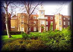 |
Lordship
Lane,
London N17 8NU Map E-mail Bruce Castle Museum Bruce Castle Museum Web site |
Phone: +44 (0)20 8808 8772 - Fax: +44 (0)20 8808 4118 | |||||||||||||||||||||||||||||||||||||||||||||
| Yiewsley and West Drayton | ||||||||||||||||||||||||||||||||||||||||||||||||
 |
For a full list of theatres in the
UK. Click on to Showtime |
THE GARDENS OF MIDDLESEX & NORTH OF THE THAMES LONDON
GOLF COURSES IN MIDDLESEX (click on a course for full details) |
|||||||||||||||||||||||||||||||||||||||||||||||||||||||||||||||||||||||||||

|
|||||||||||||||||||||||||||||||||||||||||||||||||||||||||||||||||||||||||||
 |
 |
| Park Lane Stables | Park Lane Teddington Middlesex TW11 0HY Tel: 0208 977 4951 |
||
Gillian's Riding School |
 |
Gillian/Hayley Head Bray Side Farm Beggars Hollow Clay Hill Enfield Middlesex EN2 9JL(Map). Tel: 020 8366 5445 |
At Gillian's Riding School we
aim to provide you with a relaxing, friendly family
environment for you to enjoy horses. We cater for a
wide range of riders; you can develop your dressage
techniques, enjoy a relaxing ride around Whitewebbs
woodland, or learn how to show jump and much more!
We have a range of instructors with different
teaching styles and experience, as well as a large
selection of horses. We have many breeds form show
jumpers to Shetlands! Our Riding School is a family
run business and we have over 40 years of
experience.We have a pony club for children on
Wednesdays and Saturdays, and we also do pony rides
for our under fives! |
Goulds Green Riding School |
 |
The Stables Goulds Green Hillingdon Middlesex UB8 3DG Tel:- Fax :- |
Goulds Green Riding School is proud to announce the occasion of it’s 51st anniversary. Although running in a small way a few years earlier we generally consider 1959 to be the year it became firmly established and the year of our first show. Now being run by the third generation of the Jupp family we still try to maintain a friendly atmosphere, as although health and safety issues are important we consider learning to ride should be an enjoyable and fun experience. |
| Littlebourne Equestrian Centre | Littlebourne Farm Northwood Road Harefield Middlesex UB9 6PU |
Littlebourne
Equestrian Centre is one of the few BHS Approved
Horse Riding Schools and Livery Yards on the
doorstep of London. Only a few minutes from
Harefield, surrounded by hundreds of acres of
greenbelt countryside, Littlebourne offers an
excellent range of riding activities for beginners
and experienced riders alike. |
|
| Moor Stud Riding Stables | Hithermoor Road Stanwell Moor Village Staines Middlesex TW19 6BH Tel : 01753682967 |
||
| The Edge Livery Stables, |
Edgwarebury Lane, Edgware, Middlesex, HA8 8QS. Tel : 020 89584343 |
||
| S E Lloyd, | Edgwarebury
Lane, Edgware , HA8 8QS Tel : 020 89586781 |
||
| Brayside Farm DIY Livery, | Clay Hill, Enfield, Middlesex, EN2 9JL Tel : 020 83637064 |
||
| Kings Oak Equestrian Centre | Kings Oak
Riding School/Theobalds Park Road, Crews Hill,
Enfield, Middlesex, EN2 9BL 020 83637868 |
||
| Names And Numbers Riding School | Names And Numbers 30 Lonsdale Drive Enfield Middlesex EN2 7LH Tel: 020 83670605 |
||
| Woodhurst Farm
Livery |
Woodhurst Cattlegate Road Enfield Middlesex EN2 8AU Tel : 01707 873123 |
||
| Old Farm Stables |
Oak Avenue Hampton Middlesex TW12 3QD Tel : 020 89799470 |
||
| Abbeyfields |
 |
139 Charville
Lane Hayes Middlesex UB4 8PB Tel : 020 88413362 Email : info@abbeyfields.info |
We offer horse
riding lessons to children (5 yrs and up) and adults
of all abilities. We are situated in 100 acres of
green belt in Hayes, Middlesex and adjacent to a
bridleway network. We hold pony mornings for
children during school holidays. DIY livery is
available and we sometimes have horses and ponies
for sale. |
| Jacks Riding
Stables |
Fore Street Pinner Middlesex HA5 2ND Tel : 01895 676051 |
||
| Grove Farm |
Warren Lane Stanmore Middlesex HA7 4LE Tel: 020 84206562 |
||
| Lower Priory Farm
Livery Yard |
Clamp Hill Stanmore Middlesex HA7 3JJ Tel :020 89541864 |
||
| Sunbury Riding School | Fordbridge Road Sunbury on Thames Middlesex TW16 6AS Tel : 01932 789792 |
||
| R Alder |
St. Peters Road Uxbridge Middlesex UB8 3SD Tel : 01895 442737 |
||
| LONDON POSTAL AREA NORTH & WEST STABLES |
|||
| Belmont
Riding
Centre Ltd |
 |
Belmont Farm The Ridgeway London NW7 1QT Tel : 020 89061255 |
I have
been riding at a riding school called Belmont Riding
Center. Its near Mill Hill in London. I had been
riding there for about 3 months, when a new horse
arrived from somewhere. The instructor gave him to
me for one of the the class lessons, and I was one
of the first to ride him. In fact only about three
of the schools clients rode Bert in his time there.
Bertie was highly strung. The first time I got on
him I daren't put my feet in the stirups for fear
that the contact of the stirrups on his side would
send him into gallop. By the end of the lesson, I
had come to the conclusion, that Bertie resembled a
polo pony, and on those grounds I had an
affectionate spot for him. I later found out that he
was a reject from the polo school and had been sent
to the riding school to see if he was good for
anything. I rode him in lessons for about five
months ... I often thought that if I were to have a
horse again I might like something like Bert. Then
one day I turned up at the yard to be told that Bert
was being got rid of ... this was the last ride I
would ever have on him ... and then the ultimatum
... buy him or say good bye !!! The descision was frought with panic ... I was unprepared for such a dilema ... but another five months on and I am the happiest I have been for a long time. |
| Frith Manor
Equestrian Centre |
 |
Lullington Garth London N12 7BP Tel : 020 83466703 Email us |
This is a livery
yard where atmosphere is paramount. Everybody just
loves it here. Located on the Mill Hill / Totteridge
borders in North London, we have two outdoor
floodlit ménage's and an indoor school. We can also
provide all year turn out, weather permitting in 30
acres of Totteridge countryside. The main aim of the
yard is to enjoy the equine experience, in the
company of other knowledgeable people, who share the
same passion.Options for DIY, or Full/Part Livery if
you wish. The choice is yours. |
| Hyde Park Riding Stables |  |
63 Bathurst Mews London W2 2SB Tel : 020 77063806 E-mail: info@hydeparkstables.com |
Rotten Row, in
London's Hyde Park, has been the most famous
equestrian venue in England for 300 years. Hyde Park
Stables offer horse riding and horse riding lessons
all year round in Central London on horses and
ponies chosen for their safe temperament. There are
five miles of bridleways for horse riding in
London's Hyde Park beside the Serpentine Lake, in
the most beautiful setting for horse riding in a
Capital City anywhere in the world. There are also
two outdoor riding arenas, for more formal horse
riding lessons and dressage. Our riding stables in
Hyde Park, London, cater for riders of all
abilities, previous experience is not necessary.
Hyde Park Stables London take adults and children
for both group and private horse rides and horse
riding lessons. So if you are looking for horse
riding in London, or pony riding in London for a fun
day out, or you are interested in a course of horse
riding lessons in central London then contact us
today at the Hyde Park Riding Stables, London's
premier horse riding school. |
| Knightsbridge Riding Club |  |
11 Elvaston Mews London SW7 5HY Tel : 020 75842211 |
CLOSED
Horses have been stabled at Elvaston
Mews in Knightsbridge for more than 170 years but a
combination of spiralling insurance costs and the
effects of the credit crunch have forced the owners
out of business, and the property is to be converted
into a home complete with basement extension and
"Juliet" balconies. |
| London
Equestrian Centre |
 |
Lullington Garth London N12 7BP Tel : 020 83491345 Email: The London Equestrian Centre |
Set in thirty
four acres of its own green belt land overlooking
Totteridge Valley you would be hard pressed not to
think you were in the heart of the country when, in
fact, you are only minutes away from the centres of
Mill Hill, Finchley, Hendon and just eight miles
from Oxford Street! Over the last twenty years, the
LEC has taught thousands of adults and children to
ride, for fun, to compete or for formal training for
BHS examinations. The LEC is fully approved by The
British Horse Society as a riding school. The LEC
trains student instructors and is both a livery and
competition centre. At the LEC our instructors are fully qualified so you can rest assured that adult or child, novice or experienced rider you will be taught competently and to the highest standard. |
| Ross Nye
Riding Stables |
 |
8 Bathurst Mews London W2 2SB Tel : 020 72623791 |
Set in the
historic Bathurst Mews in London, W2, Ross Nye
Stables is ideally situated for riding in London,
along the famous 'Rotten Row' in Hyde Park. The
Stables reflect the philosophy of their founder,
Ross Nye, and offer a unique and rare experience for
adults and children alike. This remains one of the
main reasons the stables have been so popular since
their foundation in 1965. As well as riding in Hyde
Park, the Ross Nye Stables is able to offer
instruction in the outdoor arena, lessons in stable
management, a membership scheme, regular
newsletters, outings to famous horsey events, and
social activities.We welcome all, whether
adults or children, beginners or experienced, for a
gentle hack in the Park or for a course of lessons.
Unfortunately we cannot cater for children under the
age of six. We operate a weight limit of 14
stone |
| Trent Park
Equestrian Centre |
 |
Bramley Road London N14 4UW Tel : 020 83638630 |
Here at Trent
Park, we have something to suit everyone, from group
and individual riding lessons and equestrian courses
to our horse riding parties and horse hacking.There
are lots of fun horse riding activities at Trent
Park, including: * Jumping clinics * Pony camps * Blazing saddles riding club * Client shows * Dressage competitions |
| Ealing Riding School |  |
17-19
Gunnersbury Avenue. Ealing.
London. W5 3XD Tel: 020 8992 3808. Email : admin@ealingridingschool.net |
We are a
B.H.S. and A.B.R.S. approved
establishment. We cater for children (5yrs + )
and adults from complete beginners to advanced.All
teaching is conducted in our outdoor schools by
Qualified Instructors, using a variety of well
schooled horses and ponies. In times of severe
weather conditions, theory of horsemanship is
conducted in our lecture room, which also houses our
course work studies, our lecture room is fully
equipped with TV & Video etc. Full shower,
washroom and nappy changing facilities are
available.We welcome all visitors to come in and
have a look around and watch a lesson being taught. |
| Kentish Town City Farm |  |
1 Cressfield
Close, off Grafton Road, London, NW5 4BN Tel:020 7916 5421 |
The Riding
Programme aims to provide access to horses and
riding for young people and those with special needs
living in Camden at affordable rates. It relies
heavily on young, committed volunteers. Pony Club is
open to Camden Residents aged 8 to 16. Pony club
currently has a three year waiting list. The list is
now closed but opens for one month in September.
Children must be aged 7+ and proof of Camden
Residence is required. Pony Club membership lasts
for two years only. Pony Rides for children
over the age of four. Every Saturday (Weather
permitting) at 1:30pm and cost £1 a ride. From March
to September please make sure you call beforehand as
often the horses are taken out to shows. 020 7916
5421 Adult Riding - THE WAITING LIST IS NOW
CLOSED DUE TO HIGH DEMAND. Adult riding runs during
the week/daytime only. The Farm offers lessons for
those wishing to refresh their skills or complete
novices - bookings are for a block of four sessions
(once a week) and include basic stable management.
Costs £60 for the four sessions. |
| The Wormwood Scrubs Pony Centre |  |
30 Sunningdale
Avenue London W3 7NS The Wormwood Scrubs Pony Centre is situated at the south east corner of Wormwood Scrubs, off Scrubs Lane. Tel : 020 8740 0573 or by e-mail |
The Wormwood
Scrubs Pony Centre was founded as a registered
charity in 1989 to provide riding lessons, equine
assisted therapy and horse care lessons to children
and young people. It is situated on the edge of
Wormwood Scrubs, an oasis of green in the inner city
London borough of Hammersmith and Fulham and serves
a diverse community from a range of social, economic
and ethnic backgrounds, including people with
disabilities. By working and caring for the animals,
children learn how to work and integrate with each
other within a broad, supportive educational
experience and in a safe, structured environment.The
ethos of the Centre demonstrates a high level of
committment to the therapeutic value of riding and
being with horses and provides a valuable resource
for people who may, through financial, social or
ethnic disadvantage, not otherwise have access to
such opportunities.Instructors are qualified and
experienced and the school is approved under the BHS
approved riding school scheme to ensue the highest
levels of care and safety. |
| www.merciatouristboard.org.uk
|
www.wessextouristboard.org.uk | www.wessex.me.uk |
| A
|
Details
above are overall visitors to all sites
+Today's
Visitors
|
C
|